
Lighthouses of Indonesia: Northern Java
Indonesia has been independent since 1945, after having been the Dutch East Indies for more than 350 years. It is a huge country, stretching along both sides of the Equator for more than 46 degrees of longitude (roughly 5100 km or 3200 miles). Comprised of some 17,000 islands (more than 6000 inhabited islands), it has hundreds of major aids to navigation. Unfortunately, we have no idea how many of these aids can be considered lighthouses. Information about them is scarce, and photos are even scarcer. Official light lists contain dozens of entries for "framework towers" and "white beacons," providing little guidance for the lighthouse fan.
The island of Java (Jawa in Indonesian) is the heart of the country and home to 57% of the population. In fact, with more than 140 million residents it is the world's most populous island. The national capital, Jakarta, is on the northwestern coast of Java.
This page includes lighthouses of the well-populated central northern coast of Java, including the Jakarta Special Capital Region and the north coasts of West Java and Central Java Provinces. (West Java and Central Java Provinces have two coasts: a north coast facing the Java Sea and a south coast facing the Indian Ocean.)
The Indonesian word for a lighthouse is mercusuar or (in two words) mercu suar. The phrase menara suar, which includes the Arabic word menara, is sometimes used instead. Tanjung and ujung are words for capes, pulau is an island, selat is a strait, karang is a reef, teluk is a bay, and pelabuhan is a port or harbor.
The original Dutch names of historic lighthouses, if known, are shown in curly brackets {}.
Aids to navigation in Indonesia are operated and maintained by the Directorate General of Sea Navigation.
ARLHS numbers are from the ARLHS World List of Lights. Admiralty numbers are from volume Q of the Admiralty List of Lights & Fog Signals. U.S. NGA List numbers are from Publication 112. General Sources Leuchttürme in Indonesien
Photos posted by Andreas Köhler. Lighthouses in Indonesia
Wikimedia photos, including a collection of historic photos from the collection of the Tropenmuseum in Amsterdam. World of Lighthouses - Indonesia
Photos by various photographers available from Lightphotos.net. Online List of Lights - Indonesia
Photos by various photographers posted by Alexander Trabas. The Semarang photos are by Jim Smith. Indonesian Lighthouses
Historic postcard views from the collection of Michel Forand. Leuchttürme Asiens, Australiens, und Ozeaniens auf historischen Postkarten
Historic postcard views posted by Klaus Huelse. 
Edam (Pulau Damar) Light, Jakarta, August 2007
Flickr photo copyright Deni Adam Mali
permission requested
Jakarta Special Capital Region Lighthouses Kepulauan Seribu (Seribu Islands) Regency Lighthouses
Note: The Seribu Islands (or Thousand Islands) are a chain of small islands extending north from near Jakarta into the Java Sea. Many of the islands are protected within a marine national park, but several have resort developments. The islands are administered as part of the Capital Territory of Jakarta. Jaga Utara (Pulau Sebira, Pulau Seribu, North Watcher) {Noord Wachter}
1869. Active; focal plane 48.5 m (159 ft); two white flashes every 11 s. 48 m (157 ft) 16-sided cast iron skeletal tower with lantern, gallery, central cylinder, and a 1-story keeper's house enclosed in the base. Lighthouse painted white. Staffed coast guard station with several buildings. A closeup photo is at right, another closeup is available, Tommy Bernardus has a photo, Cecep Suryadi has a photo, a historic photo is available, and Bing has a satellite view of the station. This is the oldest surviving Dutch lighthouse in Indonesia. The Indonesian jaga utara and the Dutch noord wachter both mean "north watcher" or "guardian of the north." Located on the northernmost island of the chain of the Seribu chain, about 65 km (40 mi) east of the Sumatran coast and 130 km (80 mi) north northwest of Jakarta. Accessible only by boat. Site status unknown. ARLHS IDO-062; Admiralty Q1042; NGA 23376. Pulau Payung Besar (Big Umbrella Island) (2)
Date unknown (station established 1890). Active; focal plane 32 m (105 ft); two white flashes every 10 s. 30 m (98 ft) square skeletal tower with lantern and gallery, painted white. A photo is available, Beta Hapsari has a distant view, Rafi Fikri has a second distant view, and Google has a good satellite view. The original lighthouse was similar but not identical to the present light. Located on a small island about 32 km (20 mi) east of Pulau Tunda and 90 km (55 mi) northwest of Jakarta. Accessible only by boat. Site status unknown. ARLHS IDO-236; Admiralty Q1058; NGA 23364. Pulau Peniki (South Watcher) {Zuid Wachter}
Date unknown. Active; focal plane 32 m (105 ft); white flash every 5 s. 35 m (115 ft) square skeletal tower with lantern and gallery, painted white. Staffed coast guard station with several buildings. No photo available but Google has a satellite view. This light greets vessels bound for Jakarta from Singapore. Located on a small island in the Java Sea about 90 km (55 mi) north northwest of Jakarta. Accessible only by boat. Site status unknown. ARLHS IDO-238; Admiralty Q1060.5; NGA 23372. Gosong Dapur
Date unknown. Active; focal plane 15 m (49 ft); two white flashes every 8 s. 15 m (49 ft) square white skeletal tower mounted on a platform supported by piles. No photo available but Google has a distant satellite view. Locared on a reef on the approach to Jakarta, about 15 km (9 mi) west northwest of the Edam lighthouse (next entry). Accessible only by boat. Site open, tower closed. Admiralty Q1061; NGA 23370. 
Jaga Utara Light, Java Sea, October 2017
Google Maps photo by Wawan Wan
Pulau Damar Besar {Edam}
1881. Active; focal plane 55 m (180 ft); four white flashes every 20 s. 50 m (164 ft) 12-sided cast iron tower with lantern and gallery. Entire lighthouse painted white. Staffed coast guard station with several buildings. Deni Adam Malik's photo is at the top of this page, Rodang Loren has a view from the sea, Michael Thirnbeck has an aerial photo, Wikipedia has a distant aerial photo (misidentified as Pulau Seribu), and Google has a satellite view. Staffed by a crew of five. This famous lighthouse traditionally welcomes travelers to Jakarta. It was prefabricated in the Netherlands by Nering Bögel, Deventer. Located on Pulau Damar Besar in the center of the entrance to the bay of Jakarta. Accessible only by boat, but apparently boats can be chartered in Jakarta. ARLHS IDO-061; Admiralty Q1062; NGA 23404.
Jakarta City Lighthouses Muara Karang
Date unknown. Active; focal plane 17 m (56 ft); white flash every 3 s. 15 m (49 ft) round white concrete tower. No photo available but Google has a satellite view. Located on the east side of the entrance to an industrial canal on the west side of Jakarta's harbor. Site and tower closed. Admiralty Q1070; NGA 23416.1.
Sunda Kelapa Harbor West (2)
Date unknown. Active; focal plane about 17 m (56 ft); two green flashes every 6 s. 17 m (56 ft) round hourglass-shaped tower, painted green. Bill Strong has a photo and Bing has a distant satellite view. This light replaced a much shorter light listed by NGA. Located at the end of the west breakwater of the harbor. Accessible only by boat. Site open, tower closed. Admiralty Q1069.4; NGA 23412. Sunda Kelapa Harbor East (2)
Date unknown. Active; focal plane about 17 m (56 ft); two red flashes every 6 s. 17 m (56 ft) round hourglass-shaped tower, painted red. Suharwan has a photo, Augusto Sunga has a photo of the lighthouse in silhouette, and Bing has a distant satellite view. This light replaced a much shorter light listed by NGA. Located at the end of the west breakwater of the harbor. Accessible only by boat. Site open, tower closed. Admiralty Q1069; NGA 23408. Jakarta {Batavia} West Mole (Sunda Kelapa)
1862. Active (?); focal plane 17 m (56 ft); red flash every 3 s. 16 m (52 ft) round stone tower with gallery, painted white. Original lantern removed. A photo is at right, another photo is available, a page for the lighthouse has recent and historic photos, the Tropenmusuem has historic photos, Forand has a historic postcard view, and Google has a street view and a satellite view. Several sources describe the lighthouse as inactive but it remains on the international light lists. The lighthouse is now immediately adjacent to the Jakarta Fish Port. As part of the redevelopment of this harbor, the lighthouse was to be refurbished; however, we do not know the status of this planned restoration. Located on the east side of the mole, about 1200 m (3/4 mi) south of Kelapa Harbor lights. Site status unknown. ARLHS IDO-063; Admiralty Q1068.5; NGA 23416. 
Sunda Kelapa Light, Jakarta, December 2016
Wikimedia Creative Commons photo by Rochelimit
Sunda Kelapa Entrance North
Date unknown. Active; focal plane 12 m (39 ft); green flash every 5 s. 12 m (39 ft) octagonal cylindrical tower painted green. This light is at the left in Joshua Stefanini's photo (at right), Terry Allen has a photo of the two entrance lighthouses, Chris Brown has a second photo, and Google has a satellite view. Located off the east side of the Sunda Kelapa quay. Accessible only by boat but easily seen from shore. Site open, tower closed. Admiralty Q1072.7; NGA 23417. Sunda Kelapa Entrance South
Date unknown. Active; focal plane 12 m (39 ft); red flash every 6 s. 12 m (39 ft) octagonal cylindrical tower painted green. This light is at the right in Joshua Stefanini's photo (at right), Terry Allen has a photo of the two entrance lighthouses, Chris Brown has a second photo, and Google has a satellite view. Located off the east side of the Sunda Kelapa quay. Accessible only by boat but easily seen from shore. Site open, tower closed. Admiralty Q1072.8; NGA 23417.1. ** Jakarta Harbor (Batavia Marina) (2)
Date unknown. Active; focal plane 20 m (66 ft); white flash every 2.5 s. Approx. 22 m (72 ft) octagonal light tower atop a square cylindrical glass-enclosed tower attached to the side of a 5-story building. Google has a street view and a satellite view. This appears to be a historic building recently converted to an upscale marina and restauarant. Located just east of the Sunda Kelapa quays. Site open; it appears that visitors can climb to the gallery. Site manager: Batavia Marina. Admiralty Q1068; NGA 23420. 
Sunda Kelapa Entrance Lights, Jakarta, July 2015
Flickr Creative Commons photo by Joshua Stefanini
Karang Nirwana
Date unknown. Active; focal plane 13 m (43 ft); green flash every 5 s. 13 m (43 ft) round barbell-shaped green fiberglass tower mounted on a square platform supported by piles. No photo available but Google has a satellite view. This light and several similar lights nearby are important guides for ships arriving in Jakarta. NGA lists it as Pulau Nirwana but there is no island. Located on a reef about 10 km (6 mi) off the Jakarta waterfront, northeast of the traditional harbor and northwest of Tanjung Priok. Accessible only by boat. Site open, tower closed. Admiralty Q1064; NGA 23406. Tanjung Priok West Mole (2)
Around 2015. Active; focal plane 22 m (72 ft); green flash every 4 s. 20 m (66 ft) round cylindrical tower. Entire lighthouse is green. Syaman Kawanan has a photo, Lightphotos.net has a distant view of the two breakwater lights, and Google has a satellite view. The original light was a green twin of the east mole light; it disappeared from the satellite views around 2014. Tanjung Priok, at Tipar in east Jakarta, is a modern containership port and ferry terminal. Located at the end of the west breakwater of Tanjung Priok harbor. Site open, tower closed. Admiralty Q1073.8; NGA 23436.5. Tanjung Priok Range Front
Date unknown. Active; focal plane 27 m (89 ft); white light, 1 s on, 1 s off. 25 m (82 ft) square skeletal tower, painted white and carrying a triangular daymark, point up. No photo available but Google has a satellite view. Located on a quay of the the Tanjung Priok harbor waterfront at Tipar, in east Jakarta. Site status unknown. Admiralty Q1073.3.
Tanjung Priok Range Rear
Date unknown. Active; focal plane 43 m (141 ft); white, red or green light depending on direction, occulting once every 4 s. 41 m (131 ft) square skeletal tower, painted white and carrying a triangular daymark, point down. Google has a street view and a satellite view. Located on the Tanjung Priok harbor waterfront at Tipar, in east Jakarta. Site status unknown. Admiralty Q1073.31. Pelabuhan Tanjungpriok (Tarusan Entreport) Leading
Date unknown. Active; focal plane 40 m (131 ft); continuous light, white, red or green depending on direction. Approx. 35 m (115 ft) square white skeletal tower. No photo available but Google has a satellite view. Located on the Tanjung Priok harbor waterfront at Tipar, in east Jakarta. Site status unknown. Admiralty Q1073.4; NGA 23429. Tanjung Priok (Tipar) Inner Harbor
Date unknown (station established 1885). Active; focal plane 46 m (151 ft); white flash every 10 s. 40 m (131 ft) square skeletal tower with lantern and gallery, painted with red and white horizontal bands. Trabas has Rainer Arndt's photo and Bing has a satellite view. Located on the Tanjung Priok harbor waterfront at Tipar, in east Jakarta. Site status unknown. Admiralty Q1073.5; NGA 23428. Tanjung Priok East Mole
Date unknown. Active; focal plane 22 m (72 ft); red flash every 4 s. 20 m (66 ft) round fiberglass tower with an octagonal base and a flared top. Entire lighthouse is red. A photo by Klaus Ottes is at right, Lightphotos.net has a distant view of the two breakwater lights, and Google has a satellite view. Located at the end of the east breakwater of Tanjung Priok harbor. Site open, tower closed. Admiralty Q1076; NGA 23436. 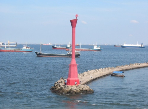
Tanjung Priok East Mole Light, Jakarta, December 2006
Flickr photo (no longer online) copyright Klaus Ottes; used by permission
Jawa Barat (West Java) Province North Coast Lighthouses Bekasi Regency Lighthouse Tanjung Kerawang
Date unknown. Active; focal plane 13 m (43 ft); two red flashes every 8 s. 14 m (46 ft) concrete tower, painted red. No photo available but Bing has an indistinct satellite view. Located on a reef about 2 km (1.2 mi) off the cape, marking the eastern entrance to the bay of Jakarta. Accessible only by boat. Site open, tower closed. Admiralty Q1078; NGA 23396.
Indramayu Regency Lighthouses Indramayu
Date unknown. Active; focal plane 15 m (49 ft); white flash every 5 s. 10 m (33 ft) round white tower. No photo available but Google has a satellite view. Located on the waterfront of a large electric power plant at Indramayu. Site and tower closed. Admiralty Q1083.3.
Pulau Biawak (Pulau Rakit) {Boompjes Eiland}
1872. Active; focal plane 54 m (177 ft); white flash every 15 s. 50 m (164 ft) 16-sided cast iron skeletal tower with lantern, gallery, and central cylinder. Although listed by NGA as black and white, the lighthouse is now painted all white. A photo is at right, another photo is available, and Google has a satellite view. This lighthouse was prefabricated by Grofsmederij Leiden in the Netherlands. The present lantern was added in 1911. Located on a small island about 65 km (40 mi) northeast of Kandanghaur in the Java Sea. Site status unknown. ARLHS IDO-074; Admiralty Q1084; NGA 23460. * Pelabuhan Balongan
Date unknown. Active; focal plane about 45 m (148 ft); light characteristic unknown. Approx. 40 m (131 ft) square skeletal communications tower painted with red and white horizontal bands. This is a landfall light for a large Pertamina oil terminal. Google has a street view and a satellite view. Located beside a main street in Balongan. Site open, tower closed. Admiralty Q1087.
Cirebon Regency and City Lighthouses Note: Cirebon is a major city near the eastern border of West Java Province. The metropolitan population is estimated at neary 2.5 million. Karang Tanah (Cirebon Approach)
Date unknown. Active; focal plane 14 m (46 ft); two white flashes every 5 s. 14 m (46 ft) "white beacon," according to NGA; this is probably a round fiberglass tower mounted on a platform supported by piles. No photo available but Bing has a distant satellite view. Located on a reef about 25 km (15 mi) north northeast of Cirebon. Accessible only by boat. Site open, tower closed. Admiralty Q1090; NGA 23472. Cirebon Range Front
Date unknown. Active; focal plane 12 m (39 ft); white flash every 5 s. 12 m (39 ft) square skeletal tower painted white and mounted on a platform supported by piles. No photo available but Bing has a satellite view. Located just off the waterfront on the north side of Cirebon harbor. Site status unknown. Admiralty Q1092.5; NGA 23480. Cirebon Range Rear
Date unknown. Active; focal plane 19 m (62 ft); nine quick white flashes every 15 s. 17 m (56 ft) square skeletal tower with gallery, painted white. Google has a street view and a satellite view. Located on the north side of Cirebon harbor, 600 m (3/8 mi) southwest of the front light. Site status unknown. Admiralty Q1092.51; NGA 23484. 
Pulau Biawak Light, Java Sea, July 2007
Panoramio photo copyright bstwan
permission requested
* Cirebon (2)
Date unknown (station established 1867). Active; focal plane 31 m (102 ft); three white flashes every 20 s. 30 m (98 ft) octagonal skeletal tower with lantern and gallery, painted white. Tjetjep Rustandi has a 2012 photo, Nancy Kie Sheng has a good photo, a closeup of the lighthouse in action is available, and Google has a satellite view. Located on the mole on the east side of inner harbor at Cirebon. Site open, tower closed. ARLHS IDO-123; Admiralty Q1092; NGA 23476.
Jawa Tengah (Central Java) Province North Coast Lighthouses Brebes Regency Lighthouse Ujung Brebes
Date unknown. Active; focal plane 22 m (72 ft); white flash every 4 s. 20 m (66 ft) square skeletal tower with lantern and gallery, painted white. No photo available, but Google has a satellite view. Ujung Brebes is not a cape but a delta formed by sedimentation along the mouth of the Brebes River; continued sedimentation has pushed the point of land 1.2 km (3/4 mi) north of the lighthouse. Located 12 km (7.5 mi) north northwest of Brebes. Site status unknown. ARLHS IDO-348; Admiralty Q1101; NGA 23502.
Tegel City and Regency Lighthouses Note: Tegal is a seaport and industrial center at the northwestern corner of Central Java Province. The population inside the city limits is about 250,000 and the metropolitan population exceeds 1.3 million. * Tegal East Side
Date unknown. Active; focal plane 19 m (62 ft); white flash every 3 s. 13 m (43 ft) square skeletal tower painted white. Google has a street view and a distant satellite view. Located on the quay in Tegal. Site open, tower closed. Admiralty Q1106; NGA 23508. * Tegal (Rede Tegal) (2)
Date unknown (station established 1880). Active; focal plane 32 m (105 ft); white light, 5 s on, 5 s off. 30 m (98 ft) square tapered skeletal tower, painted white. No photo available, but the tower is seen in a Google street view and satellite view. Huelse has a postcard view of the original Dutch lighthouse, and Forand has a second postcard view. Located just east of the harbor of Tegal, a port about 25 km (15 mi) west of Pemalang. Site open, tower closed. ARLHS IDO-263; Admiralty Q1105; NGA 23504. Karang Jeruk
Date unknown. Active; focal plane 16 m (52 ft); white flash every 5 s. 16 m (52 ft) square white skeletal tower mounted on a platform supported by piles. No photo available and the light is not seen in Google's satellite view. Located on a reef about 6 km (3.5 mi) northeast of Tegal. Accessible only by boat. Site open, tower closed. Admiralty Q1102; NGA 23520.
Kendal Regency Lighthouses
* Tanjung Celong
Date unknown. Active; focal plane 30 m (98 ft); white flash every 4 s. Approx. 25 m (82 ft) tapered square pyramidal skeletal tower, painted white. Fahrizal Utama has a photo, Gondang Hadi has a 2016 closeup, and Bing has a satellite view. Located on the east side of an estuary entrance at Gempolsewu. Site open, and several photos show visitors climbing the tower. ARLHS IDO-299; Admiralty Q1128; NGA 23539. * Pelabuhan Kendal
2016. Active; focal plane 14 m (46 ft); white flash every 5 s. 10 m (33 ft) square white skeletal tower. Paidulz Dudulz has a distant view from the sea, Fadhilur Rahman has an aerial photo, and Google has an indistinct satellite view. Located on the waterfront of Kendal harbor. Admiralty Q1129.8.
Semarang City Lighthouses Note: Semarang, the capital city of Central Java Province, is an important port. The population of the city proper is about 2 million, with 6 million in the metropolitan area. Semarang West Outer Breakwater (1)
Date unknown. Replaced. This was a 12 m (39 ft) round green fiberglass tower, flared at the top. James Arjuna's photo is at right and Google has a satellite view. Trabas has Smith's photo of the current post light (focal plane 14 m (46 ft); green flash every 10 s). Semarang has long outer breakwaters protecting the port from monsoon-driven waves. Located at the end of the west breakwater, which is 3.5 km (2.2 mi) long. Accessible only by boat. Site and tower closed. Current light: Admiralty Q1134; NGA 23558. 
West Outer Breakwater Light, Semarang, November 2010
Panoramio photo copyright James Arjuna; used by permission
Semarang East Outer Breakwater (1)
Date unknown. Replaced. This was a 12 m (39 ft) round red fiberglass tower, flared at the top. No photo available, but Google has a satellite view. Trabas has Smith's photo of the current post light (focal plane 14 m (46 ft); red flash every 10 s). Located at the west end of the detached east breakwater. Accessible only by boat. Site and tower closed. Admiralty Q1133.3; NGA 23557. * Semarang (Tanjung Emmas, Mercusuar Willem III) (2)
1883 (station established 1872). Active; focal plane 33 m (108 ft); four white flashes every 20 s. 30 m (98 ft) 12-sided cast iron tower with lantern and gallery. Entire lighthouse painted white. Badroe Zaman's photo is at right, a 2008 photo is available, Köhler has a 2011 photo, Trabas has Smith's photo, Wikimedia has a photo, Lightphotos.net has a closeup of the lantern, the Tropenmuseum has a historic photo, Huelse has a historic postcard view, Forand has a different postcard view, and Google has a street view and a satellite view. The lighthouse is named for William III, the king of the Netherlands from 1849 to 1890. Located on a promontory on the east side of the harbor of Semarang, a major port of central north Java. Site open, tower closed. ARLHS IDO-040; Admiralty Q1132; NGA 23560. Semarang Range Front
Date unknown. Active; focal plane 27 m (89 ft); white flash every 2 s. 25 m (82 ft) square skeletal tower painted with black and white horizontal bands. The tower also carries a triangular daymark, point up, painted black with a white vertical stripe. Trabas has Smith's photo and Google has a street view and a satellite view. Located on a quay in the middle of the Semarang harbor district. Site status unknown, but the tower can be seen from nearby streets. Admiralty Q1133; NGA 23552. * Semarang Range Rear
Date unknown. Active; focal plane 32 m (105 ft); white flash every 3 s. 30 m (98 ft) square skeletal tower painted with black and white horizontal bands. The tower also carries a triangular daymark, point down, painted black with a white vertical stripe. Trabas has Smith's photo and Google has a street view and a satellite view. Located beside Ampenan Street at the south end of the Semarang harbor. Site open, tower closed. Admiralty Q1133.1; NGA 23556. 
Semarang Light, Semarang, October 2014
Google Plus photo by Badroe Zaman
Jepara Regency: Mainland Lighthouses
Note: Jepara is a small port on Java's northern peninsula, about 55 km (35 mi) north of Semarang. Pulau Panjang
Date unknown. Active; focal plane 22 m (72 ft); three white flashes every 20 s. 19 m (62 ft) square skeletal tower with lantern and gallery, painted white; lantern painted red. Staffed coast guard station with several buildings. A photo is at right, a closeup photo is available, Zulhendri Koto has a view from the beach, and Google has a good satellite view. Pulau Panjang is a small island about 3 km (2 mi) west of Jepara harbor. Located at the west end of the island. Accessible only by boat. Site status unknown. Admiralty Q1138; NGA 23584. Tanjung Kelor
Date unknown. Active; focal plane 13 m (43 ft); white flash every 4 s. 13 m (43 ft) square white skeletal tower mounted on a platform supported by piles. No photo available but Google has a satellite view. Located in Jepara Bay about halfway between Pulau Panjang and the Jepara waterfront. Accessible only by boat. Site open, tower closed. Admiralty Q1138.25. Jepara (Djapara)
Date unknown (station established 1908). Active; focal plane 17 m (56 ft); white flash every 3 s. 15 m (49 ft) white concrete post with double gallery mounted on a square concrete base. Hadi Bindowi has a street view across the estuary and Google has a satellite view. Site status unknown. ARLHS IDO-356; Admiralty Q1139; NGA 23580. Tanjung Kuniran
Date unknown. Active; focal plane 13 m (43 ft); white flash every 5 s. 13 m (43 ft) square white skeletal tower mounted on a platform supported by piles. No photo available but Google has a satellite view. Located off a promontory at Kartini, about 2.5 km (1.5 mi) north of Jepara. Accessible only by boat. Site open, tower closed. Admiralty Q1138.2. Pulau Mandalika (Mondoliko)
Date unknown (station established 1887). Active; focal plane 86 m (282 ft); white flash every 5 s. 16 m (52 ft) hexagonal skeletal tower with lantern and gallery, painted white. Staffed coast guard station with several buildings. No photo available but Bing has a satellite view of the station. Pulau Mandalika is a small island off the tip of Java's northern peninsula. Located at the highest point of the island. Accessible only by boat. Site status unknown. ARLHS IDO-224; Admiralty Q1144; NGA 23572. 
Pulau Panjang Light, Jepara, December 2006
Directorate of Small Islands photo (no longer online)
Jepara Regency: Karimunjawa Islands Lighthouses
Note: The Karimunjawa group includes 27 small islands located about 80 km (50 mi) northwest of Jepara. 22 of the islands are protected in the Karimunjawa National Park. Seven of the islands are inhabited and the permanent population is about 9000. Fast ferry service is available from Jepara and Kendal.
Pulau Nyamuk (Mosquito Island) {Pulau Njamoek} (2)
Date unknown. Active; focal plane 30 m (98 ft); three white flashes every 15 s. 30 m (98 ft) tapered square skeletal tower with lantern and gallery, painted white. Staffed coast guard station with several buildings. Amateur radio operator YF1AR has a photo (first lighthouse on the page) and Google has a satellite view of the station. Located on a small island at the western end of the archipelago, about 130 km (80 mi) north northwest of Semarang. Accessible only by boat. Site status unknown. ARLHS IDO-073; Admiralty Q1140; NGA 23568. * Karimun (Pelabuhan Karimunjawa)
Date unknown (recent). Active; focal plane 18 m (59 ft); white flash every 4 s. 15 m (49 ft) square skeletal tower with gallery, painted white. A photo is at right, another photo (halfway down the page) is available, amateur radio operator YF1AR has a photo (second lighthouse on the page), and Google has a satellite view. Located on the quay at Karimun port, near the southwestern tip of the largest island of the archipelago. Site open, tower closed. Admiralty Q1140.8. Tanjung Pudak (Pulau Karimunjawa)
Date unknown. Active; focal plane 25 m (82 ft); white flash every 3 s. 15 m (49 ft) square skeletal tower painted white. No photo available and Google has only an indistinct satellite view. Located at the southeastern tip of Pulau Karimunjawa. Site status unknown. ARLHS IDO-381; Admiralty Q1141; NGA 23569. Pulau Genting
Date unknown. Active; focal plane 50 m (164 ft); white flash every 4 s. Approx. 40 m (131 ft) square skeletal tower with lantern and gallery, painted white. No photo available but Google has a satellite view. Pulau Genting is the easternmost island of the Karimunjawa archipelago. Located at or near the north end of the island. Site status unknown. ARLHS IDO-071; Admiralty Q1140.5; NGA 23570. 
Karimun Light, Pulau Karimun, December 2017
Google Maps photo by yanuar IDC
Pati Regency Lighthouses * Tanjung Bugel (Banyutowo)
Date unknown. Active; focal plane 31 m (102 ft); white flash every 4 s. Approx. 25 m (82 ft) square skeletal tower painted white and carrying a white rectangular daymark panel. Ijang Bordir has a distant view, and Google has a satellite view. Tanjung Bugel is a low cape at the northeastern corner of Java's northern peninsula, but the lighthouse is located near the waterfront north of the pier in Banyutowo, a town about 4 km (2.5 mi) south of the cape. Site open, tower closed. Admiralty Q1144.1; NGA 23572.5. Juana (Juwana)
Date unknown. Active; focal plane 14 m (46 ft); white light, 1.2 s on, 4.8 s off. 14 m (46 ft) round white tower with gallery mounted on a square concrete platform. No photo available but Google has a fuzzy satellite view. Located on submerged bank about 2.5 km (1.5 mi) northwest of the entrance to the Juwana River. Accessible only by boat. Site open, tower closed. Admiralty Q1144.2; NGA 23572.8.
Rembang Regency Lighthouses Pulau Gurian
Date unknown. Active; focal plane 14 m (46 ft); white flash every 2.5 s. 14 m (46 ft) round white tower with gallery mounted on a square concrete platform. No photo available but Google has a distant satellite view. Located on submerged bank (not an island) about 2 km (1.25 mi) off the waterfront of Rembang. Accessible only by boat. Site open, tower closed. Admiralty Q1144.8; NGA 23573.6. * Rembang
2007 (?). Active; focal plane 33 m (108 ft); white flash every 5 s. 30 m (98 ft) square skeletal tower painted white. Google has a street view and a satellite view. Located on the waterfront of Rembang harbor. Site status unknown (Google Maps indicates an "army facility" in the area), but the tower can be seen from nearby. Admiralty Q1144.7. Tanjung Bendoh
2008 (?). Active; focal plane 30 m (98 ft); white flash every 5 s. Probably an approx. 27 m (89 ft) tower, listed only as a "white beacon" when announced by the Indian Notices to Mariners in July 2008. No photo available and the tower may be too new to appear in Google's satellite view. Located on a low cape about 25 km (15 mi) east northeast of Rembang. Site status unknown. Admiralty Q1144.85.
Information available on lost lighthouses:
Semarang West Pier (?-?), Semarang. Forand also has a postcard view of a second pier light, believed to have succeeded the other light after World War II. The present outer pier light is well to the north.
Notable faux lighthouses:
Lighthouses of Indonesia: Eastern Java
Indonesia has been independent since 1945, after having been the Dutch East Indies for more than 350 years. It is a huge country, stretching along both sides of the Equator for more than 46 degrees of longitude (roughly 5100 km or 3200 miles). Comprised of some 17,000 islands (more than 6000 inhabited islands), it has hundreds of major aids to navigation. Unfortunately, we have no idea how many of these aids can be considered lighthouses. Information about them is scarce, and photos are even scarcer. Official light lists contain dozens of entries for "framework towers" and "white beacons," providing little guidance for the lighthouse fan.
The island of Java (Jawa in Indonesian) is the heart of the country and home to 62% of the population. In fact, with more than 130 million residents it is the world's most populous island.
This page includes lighthouses of the mainland regencies of East Java (Jawa Timur) Province. In addition to the east end of Java, East Java Province also includes the island of Madura and a number of nearby smaller islands.
The Indonesian word for a lighthouse is mercusuar or (in two words) mercu suar. The phrase menara suar, which includes the Arabic word menara, is sometimes used instead. Tanjung and ujung are words for capes, pulau is an island, selat is a strait, karang is a reef, and teluk is a harbor.
The original Dutch names of historic lighthouses, if known, are shown in curly brackets {}.
Aids to navigation in Indonesia are operated and maintained by the Directorate General of Sea Navigation.
ARLHS numbers are from the ARLHS World List of Lights. Admiralty numbers are from volume Q of the Admiralty List of Lights & Fog Signals. U.S. NGA List numbers are from Publication 112. General Sources Leuchttürme in Indonesien
Photos posted by Andreas Köhler. Lighthouses in Indonesia
Wikimedia photos, including a collection of historic photos from the collection of the Tropenmuseum in Amsterdam. World of Lighthouses - Indonesia
Photos by various photographers available from Lightphotos.net. Online List of Lights - Indonesia
Coming soon: photos by various photographers posted by Alexander Trabas. Indonesian Lighthouses
Historic postcard views from the collection of Michel Forand. Leuchttürme Asiens, Australiens, und Ozeaniens auf historischen Postkarten
Historic postcard views posted by Klaus Huelse. 
Original Tanjung Awarawar Light, Tuban, June 2015
Google Maps street view
North Coast (Java Sea) Lighthouses Tuban Regency Lighthouses * Tambakbojo
Date unknown. Active; focal plane 30 m (98 ft); white flash every 3 s. 28 m (95 ft) round concrete cement silo. Google has a street view and a satellite view. Located at Socorejo, about 30 km (19 mi) northwest of Tuban. Site open, tower closed. Admiralty Q1145.5; NGA 23586. Tanjung Awarawar Range Rear
Date unknown. Active; focal plane about 20 m (66 ft); light characteristic unknown. Approx. 20 m (66 ft) square white skeletal tower on a platform supported by piles. Lukman Edi Purnomo has a distant view, and Bing has a satellite view. Located on the west side of the pier at the Tambakbojo cement plant. Site open, tower closed. Admiralty Q1145.25. Tanjung Awarawar (2)
Date unknown. Active; focal plane 70 m (230 ft); white flash every 10 s. As late as 2015 this was an approx. 30 m (98 ft) square skeletal tower with lantern and gallery, painted white; lantern painted red. Google has a street view (also seen above) and Bing has a satellite view. Google's satellite view shows that this tower has been replaced by a round concrere tower. Located in an oil refinery on a prominent cape at Mentoso near the western boundary of East Java Province. Site and tower closed. Admiralty Q1145; NGA 23574.
Lamongan Regency Lighthouse * Brondong (Van der Wijck Monument)
1938. Inactive for many years. 8 m (26 ft) square masonry tower, currently painted beige. This tower was built by Dutch authorities to recognize the heroism of the fishermen of Brondong, who saved most of the passengers and crew of the steamship Van der Wijck when it wrecked nearby in October 1936. The tower was active as a lighthouse for only a few years. The Lamongan tourism office also has a page for the tower and a photo gallery, and Google has an indistinct satellite view. Located on the east side of the harbor entrance in Brondong. Site open, tower may also be open. Tanjung Kodok
Date unknown. Active; focal plane 42 m (138 ft); white flash every 4 s. 40 m (131 ft) tapered square skeletal tower painted white. Google has a satellite view and the top of the tower is seen in a distant street view. Located on the waterfront at Tanjung Kodok, about 15 km (9 mi) east of Brondong. Site status unknown. Admiralty Q1148.
Gresik Regency Lighthouses Tanjung Mentigi (Pulau Bawean)
Date unknown. Active; focal plane 83 m (272 ft); white flash every 7 s. Approx. 30 m (98 ft) square skeletal tower, painted white. No photo available but Bing has a satellite view. Both the Admiralty and NGA misspell the name as Mantigi, and NGA lists the focal plane as 8 m rather than 83 m. Pulau Bawean is a roughly circular island, about 15 km (9 mi) in diameter, in the Java Sea 150 km (93 mi) north of Surabaya. Located on the north point of the island. Site status unknown. Admiralty Q1153; NGA 23591. * Sangkapura (Sangkapoera)
Date unknown. Active; focal plane 20 m (66 ft); white flash every 5 s. 18 m (59 ft) square skeletal tower with gallery, painted white. No photo available but Bing has a satellite view. Located on the waterfront of Sangapoera, the main town of Pulau Bawean, on the south coast of the island. Site open, tower closed. Admiralty Q1150; NGA 23588. Ujung Pangkah
Date unknown. Active; focal plane 33 m (108 ft); white flash every 6 s. Approx. 30 m (98 ft) square tapered skeletal tower with lantern and gallery, painted white. No photo available but Bing has a satellite view. Located at the tip of swampy point on the west side of the northern entrance to Madura Strait. Probably accessible only by boat. Site status unknown. Admiralty Q1157; NGA 23608.
East Coast Lighthouses Surabaya City Lighthouse * Madura Naval Wharf (Monumen Jalesveva Jayamahe)
Date unknown. Active; focal plane 9 m (30 ft); red flash every 4 s. The active beacon is a 6 m (20 ft) pyramidal red tower, but that's not the attraction here. Behind the beacon is the Monumen Jalesveva Jayamahe, a 30.6 m (100 ft) structure featuring a heroic statue of an Indonesian naval officer atop a round 5-story building. The relatively tiny beacon is in front of the monument in Autin Epriastin's view from the harbor and at lower right in Gandung Adi Wibowo's photo, and Google has a satellite view. Several sources say that the monument itself was intended as a lighthouse, but it is not recognized as a lighted navigational aid. Located on a large wharf at the naval station on the south side of the Madura Strait in Surabaya. Site open, tower closed. Admiralty Q1183.1; NGA 23648.
Probolinggo City Lighthouses Note: Probolinggo is a city of about 225,000 residents on the south coast of the Madura Strait, which separates the eastern peninsula of Java from the island of Madura. * Probolinggo West Mole (Tanjung Tembaga) (2?)
Date unknown (station established 1903). Active (?); focal plane 15 m (49 ft); green flash every 5 s. 14 m (46 ft) round hourglass-shaped tower, painted green. A photo is available, Yazid Hsn has a distant street view and Google has a satellite view. This light has been dropped from the Admiralty list. NGA lists a skeletal tower. Located at the end of the west mole at Probolinggo, on the southwest side of Madura Strait. Accessible by walking then mole. Site open, tower closed. ARLHS IDO-188; ex-Admiralty Q1212; NGA 23692. * Probolinggo East Mole (2)
Date unknown. Active; focal plane 14 m (46 ft); red flash every 6 s. 14 m (46 ft) round hourglass-shaped tower, painted red and mounted on a square platform supported by piles. Yazid Hsn has a distant street view and Google has a satellite view. NGA lists a skeletal tower. Located just off the end of the east mole at Probolinggo. Accessible only by boat but easily seen from the mole. Site open, tower closed. Admiralty Q1212.2; NGA 23696. * Probolinggo
Date unknown. Active; focal plane 23 m (75 ft); white flash every 7 s. 20 m (66 ft) square skeletal tower. Google has a street view and a satellite view. Located in the governmental office complex in the harbor area of Probolinggo. Site status unknown. Admiralty Q1210; NGA 23688.
Situbondo Regency (Madura Strait Southside) Lighthouses * Besuki (2?)
Date unknown. Active; focal plane 14 m (46 ft); white light, 1.5 s on, 2.5 s off. 14 m (46 ft) hexagonal white metal tower with lantern. Kaconx Maloloh has a view from the pier, Google has a closeup street view and a satellite view. NGA describes this light as a skeletal tower. Located at the foot of the main pier at Besuki. Site open, tower closed. Admiralty Q1214; NGA 23704.
* Panarukan {Panaroekan} (2)
Date unknown (station established 1880). Active; focal plane 15 m (49 ft); white flash every 3 s. 14 m (46 ft) hexagonal skeletal tower with lantern; the front face of the tower carries a slatted daymark painted with black and white horizontal bands. A photo (1/3 the way down the page) and a second photo (fourth photo on the page) are available, Yves Frombelgium has a distant view, Google has a similar distant street view, and Bing has a satellite view. Located in Panarukan, a fishing port about 10 km (6 mi) west of Situbondo. Site status unknown, probably open. ARLHS IDO-184; Admiralty Q1220; NGA 23708. * Jangkar
Date unknown. Active; focal plane 23 m (75 ft); white flash every 3 s. 21 m (69 ft) square skeletal tower with gallery, painted white. A photo is at right, and Google has a street view and a satellite view. Located on the waterfront at Jangkar, a town about 25 km (15 mi) west of Situbondo. Site open, tower closed. Admiralty Q1222.5. Tanjung Pecinan
Date unknown. Active; focal plane 43 m (141 ft); white flash every 5 s. Approx. 40 m (131 ft) square skeletal tower, painted white. No photo available but Google has a satellite view and a very distant street view. NGA misspells the name as Tanjung Paciman. Located on a low, swampy cape that extends into the Madura Strait about 16 km (10 mi) northeast of Situbondo. Site status unknown. ARLHS IDO-088; Admiralty Q1222; NGA 23710. Karang Mas (Gosong Karangmas, Meinderts Reef) {Meindertsdroogte} (2)
Date unknown. Active; focal plane 22 m (72 ft); white flash every 5 s. 16 m (52 ft) tower, painted black with one red horizontal band, mounted on a platform supported by piles. No photo available but Bing has a satellite view. It is possible that the present light stands on the base of the original, which apparently survived until the 1950s at least. Located about 15 km (9 mi) offshore at the southern entrance to Madura Strait. Accessible only by boat. Site open, tower closed. ARLHS IDO-366; Admiralty Q1223; NGA 23712. Tanjung Candiban
Date unknown. Active; focal plane 60 m (197 ft); white flash every 3 s. This lighthouse is described by NGA only as a "white beacon." No photo available. Bing has a satellite view of the station but the tower is not seen. Located at the northeastern tip of Java, overlooking the Bali Sea. Accessible by road. Site status unknown. ARLHS IDO-096; Admiralty Q1224; NGA 23773. 
Jangkar Light, Jangkar, June 2008
ex-Panoramio photo copyright arifngh; permission requested
Banyuwangi Regency (Bali Strait Westside) Lighthouses
Note: The Bali Strait separates Java from the smaller island of Bali to the east, connecting the Indian Ocean to the Bali Sea. The strait narrows northward to a width of only 2.4 km (1.5 mi) at its northern end. A bridge over the strait has been proposed but has not been approved.
Pulau Tabuan {Duiven Eiland} (2)
Date unknown (station established 1871). Active; focal plane 17 m (56 ft); white flash every 5 s. Approx. 14 m (46 ft) round hourglass-shaped white fiberglass tower. Long Priyono has a view from the sea, and Google has a satellite view. The original lighthouse was a skeletal tower with lantern and gallery. Located on a small island marking the west side of the northern entrance to the Bali Strait at the eastern end of Java. Accessible only by boat. Site open, tower closed. Admiralty Q1249; NGA 23774. * Tanjung Bansering Range Rear
Date unknown. Active; focal plane 28 m (92 ft); white flash every 4 s. 20 m (66 ft) octagonal concrete tower with lantern and gallery, painted white. Google has a closeup street view (a portion is seen at right), and a satellite view. This range guides vessels northbound through the narrowest passage of the Bali Strait. Accessible by road. Located in the village of Bengkak, at the northern end of the strait. Site open, tower closed. Admiralty Q1250.1; NGA 23780. Tanjung Bansering Range Front
Date unknown. Active; focal plane 15 m (49 ft); white flash every 3 s. 13 m (43 ft) octagonal concrete tower with lantern and gallery, painted white. Google has a street view and Bing has a satellite view. Located on the shore of the strait, 500 m (0.3 mi) south of the rear light. Site open, tower closed. Admiralty Q1250; NGA 23776. * Tanjung Wangi
Date unknown. Active; focal plane about 15 m (49 ft); light characteristic unknown. Approx. 12 m (39 ft) square skeletal tower. Trabas has Bjørn Poulsen's photo and Bing has a satellite view. Located on the waterfront of Tangung Wangi, an industrial port north of Banyuwangi, the regency capital. Site open, tower closed. Admiralty Q1257. Pertamina Tanjung Wangi
Date unknown. Active; focal plane about 15 m (49 ft); light characteristic unknown. Approx. 12 m (39 ft) square white skeletal tower. No photo available but Google has a satellite view. Located at the base of the pier at the Pertamina oil terminal at Tangung Wangi. Site and tower closed. Admiralty Q1257.3. Semen Bosowa Banyuwangi
Date unknown. Active; focal plane about 18 m (59 ft); light characteristic unknown. Approx. 15 m (49 ft) square cylindrical white skeletal tower. No photo available, but Google has a satellite view. Located at the Semen Bosawa LNG terminal south of Banyuwangi. Site and tower closed. Admiralty Q1258.14. 
Tanjung Bansering Range Rear Light, Banyuwangi, May 2015
Google Maps street view
Tanjung Sembulungan
Date unknown. Active; focal plane 19 m (62 ft); white flash every 3 s. 10 m (33 ft) "white beacon"; a Google satellite view reveals a white concrete post with gallery, probably rising from a square equipment shelter. Located near the end of a long, north-pointing, densely-forested peninsula that shelters the Java coast in the southern portion of the Bali Strait. Probably accessible only by boat. Site status unknown. Admiralty Q1261; NGA 23806. Tanjung Slokah
2011. Active; focal plane 33 m (108 ft); white flash every 6 s. 30 m (98 ft) square skeletal tower, painted white. No photo available and the tower is not seen in Google's satellite view. Tanjung Slokah is the extreme southeastern tip of Java; it's surprising that there has never been a lighthouse on this important cape until now. Located near the end of land. Probably accessible only by boat. Site status unknown. Admiralty Q1261.2.
South Coast (Indian Ocean) Lighthouses Jember Regency Lighthouses
#Bedadung (Watangan, Pantai Pancer) (1)
Date unknown. Inactive since 2014. Approx. 35 m (115 ft) tapered square skeletal tower with gallery, painted white. 1-story keeper's house. Google's May 2015 street view (also seen at right) shows this tower standing beside the newer one (next entry) but its satellite view shows that the old tower has been removed. Located near the beach at Puger, about 40 km (25 mi) southwest of Jember. Site status unknown. Bedadung (Watangan, Pantai Pancer) (2)
2014. Active; focal plane 42 m (138 ft); white flash every 4 s. Approx. 35 m (115 ft) octagonal tower with lantern and two galleries. Lighthouse painted white. Google has a street view (also seen at right) and a satellite view. Located in front of the earlier lighthouse. Site status unknown. Admiralty Q1261.5; NGA 23821. Pulau Barung
2007. Active; focal plane 145 m (476 ft); two white flashes every 12 s. 40 m (131 ft) square skeletal tower, painted white, rising from a 2-story station building. No photo available, but Bing has a satellite view of the station. Located on a heavily forested island about 20 km (13 mi) southeast of the Bedadung light station. Site status unknown. Admiralty Q1261.8.
Malang Regency Lighthouse Sempu (1)
Date unknown. Inactive. Approx. 10 m (33 ft) white concrete post with gallery. No photo available. Google's satellite view shows this tower leaning seaward. Located on a promontory at the entrance to a bay protected by Pulau Sempu. Site status unknown. Sempu (2)
Date unknown. Active; focal plane 23 m (75 ft); white flash every 4 s. Approx. 20 m (66 ft) square white skeletal tower. No photo available but Google has a satellite view. Located beside the earlier lighthouse. Site status unknown. Admiralty Q1262; NGA 23821.2. 
Old (left) and new Bedadung Lights, May 2015
Google Maps street view
Trenggalek Regency Lighthouses
Ujung Siklapa (Teluk Segoro Wegi)
Date unknown. Active; focal plane 51 m (167 ft); white flash every 3 s. NGA provides no description of this lighthouse but a Google satellite view reveals a round white concrete tower of unknown height. Located on a promontory about 30 km (19 mi) south of Durenan. May be accessible only by boat. Site status unknown. Admiralty Q1262.5; NGA 23821.3. Pulau Sekel
Date unknown. Active; focal plane 14 m (46 ft); white flash every 10 s. 10 m (33 ft) square white skeletal tower. No photo available but Google has an indistinct satellite view. Located on a rocky reef about 20 km (13 mi) south of Munjungan. Accessible only by boat. Site status unknown. Admiralty Q1262.6. Pulau Panehan
Date unknown. Active; focal plane 150 m (492 ft); two white flashes every 10 s. 30 m (98 ft) square skeletal tower with gallery, painted white. No photo available but Google has a satellite view. Located atop a small island about 13 km (8 mi) southwest of Munjungan. Accessible only by boat. Site status unknown. Admiralty Q1262.7.
Pacitan Regency Lighthouses Tanjung Lorog (Lorog Cape)
Date unknown. Active; focal plane 15 m (49 ft); white flash every 4 s. 15 m (49 ft) round barbell-shaped white fiberglass tower mounted on a square platform supported by piles. A view from the beach is available and Google has an indistinct satellite view. Located just off the Pidakan beach about 16 km (10 mi) east of Pacitan. Accessible only by boat. Site open, tower closed. Admiralty Q1262.79. Teluk Pacitan (Tanjung Ngamber) {Patjitan}
Date unknown. Active; focal plane 50 m (164 ft); white flash every 5 s. Approx. 30 m (98 ft) tapered square white skeletal tower. Farid Rizal's closeup photo is at right and Bing has a satellite view. Located on a promontory on the east side of the entrance to the circular harbor of Pacitan. Site status unknown. Admiralty Q1262.8; NGA 23821.5. * Pacitan Harbor
Date unknown. Active; focal plane 22 m (72 ft); white flash every 10 s. 20 m (66 ft) square skeletal tower with gallery, painted white. A 2017 closeup photo is available and Google has a street view and Bing has a satellite view. Located at the Tamperan ferry terminal at the west end of Pacitan. Site open, tower closed. Admiralty Q1262.85. 
Tanjung Ngamber Light, Pacitan, June 2018
Google Maps photo by Farid Rizal
Tamperan (Tanjung Kowang)
Date unknown. Active; focal plane 17 m (56 ft); red flash every 4 s. 10 m (33 ft) round barbell-shaped red fiberglass tower mounted on a square concrete platform supported by concrete piles. Sulthan Shalahuddin has a 2018 photo, Fendi Kurnia also has a photo, and Google has a satellite view. Probably accessible only by boat. Located on a rocky point at the western entrance to Pacitan Bay and Tamperan harbor. Site open, tower closed. Admiralty Q1262.84.
Information available on lost lighthouses:
Grisek (Gresik) (1882-?), Grisek, near Surabaya.
Pasuruan (Pasoeroean) (1880-?), Pasuruan, south of Surabaya. The current light here (Admiralty Q1204) is described as a "white mast," 18 m (59 ft) tall.
Surabaya (?-?), Surabaya. No information on this lighthouse is available.
Notable faux lighthouses:
Perak Harbor, Surabaya. Though often described as a lighthouse, this building never carried a light; it was probably the harbormaster's office. Pri Hinkap has a 2018 photo and Google has an indistinct satellite view.
Lighthouses of Indonesia: Southwestern Java
Indonesia has been independent since 1945, after having been the Dutch East Indies for more than 350 years. It is a huge country, stretching along both sides of the Equator for more than 46 degrees of longitude (roughly 5100 km or 3200 miles). Comprised of some 17,000 islands (more than 6000 inhabited islands), it has hundreds of major aids to navigation. Unfortunately, we have no idea how many of these aids can be considered lighthouses. Information about them is scarce, and photos are even scarcer. Official light lists contain dozens of entries for "framework towers" and "white beacons," providing little guidance for the lighthouse fan.
The island of Java (Jawa in Indonesian) is the heart of the country and home to 62% of the population. In fact, with more than 130 million residents it is the world's most populous island.
This page includes lighthouses of the southern and western coasts of Java, including the Yogyakarta Special Region, the south coasts of Central Java and West Java Provinces, and Banten Province at the west end of island. (West Java and Central Java Provinces have two coasts: a north coast facing the Java Sea and a south coast facing the Indian Ocean.)
The Indonesian word for a lighthouse is mercusuar or (in two words) mercu suar. The phrase menara suar, which includes the Arabic word menara, is sometimes used instead. Tanjung and ujung are words for capes, pulau is an island, selat is a strait, karang is a reef, teluk is a bay or harbor, and pelabuhan is a port.
The original Dutch names of historic lighthouses, if known, are shown in curly brackets {}.
Aids to navigation in Indonesia are operated and maintained by the Directorate General of Maritime Transportation.
ARLHS numbers are from the ARLHS World List of Lights. Admiralty numbers are from volume Q of the Admiralty List of Lights & Fog Signals. U.S. NGA List numbers are from Publication 112. General Sources Leuchttürme in Indonesien
Photos posted by Andreas Köhler. Lighthouses in Indonesia
Wikimedia photos, including a collection of historic photos from the collection of the Tropenmuseum in Amsterdam. World of Lighthouses - Indonesia
Photos by various photographers available from Lightphotos.net. Online List of Lights - Indonesia
Coming soon: photos by various photographers posted by Alexander Trabas. Indonesian Lighthouses
Historic postcard views from the collection of Michel Forand. Leuchttürme Asiens, Australiens, und Ozeaniens auf historischen Postkarten
Historic postcard views posted by Klaus Huelse. 
Klirong Light, Kebumen, February 2016
ex-Google Plus photo by wahyu budhi s
Yogyakarta Special Region Lighthouses Note: The Yogyakarta Special Region (Daerah Istimewa Yogyakarta) is an enclave facing the Indian Ocean in the southeastern corner of Central Java Province. It is unique among all regions of Indonesia in being ruled by a hereditary sultan. Gunung Kidul Regency Lighthouses Sadeng Range Front
2008. Active; focal plane 23 m (75 ft); white light, 2 s on, 2 s off. 12 m (39 ft) square skeletal tower with gallery recently enclosed with white metal panels. The tower is at the right in Hermawan C. Nugroho's 2017 photo, Muhammad Ifrad has a distant view showing both range lights, and Google has a 2014 street view (before the white panels were added) and a satellite view. Located on a hillside west of the harbor at Sadeng. Site open, tower closed. Admiralty Q1263; NGA 23821.61. Sadeng Range Rear
2008. Active; focal plane 25 m (82 ft); white light, 1 s on, 1 s off. 15 m (49 ft) square skeletal tower with gallery recently enclosed with white metal panels. Muhammad Ifrad has a distant view showing both range lights and Google has a street view (before the white panels were added) and a satellite view. Located 35 m (115 ft) northeast of the front light. Site open, tower closed. Admiralty Q1263.1; NGA 23821.62. Sadeng Breakwater (2)
Date unknown. Active; focal plane 14 m (46 ft); green flash every 4 s. 14 m (46 ft) round fiberglass tower with a flared top mounted on a square concrete platform supported by four concrete piles. Tower painted green. No photo available. A 2018 photo shows this light and the next one and Google has an indistinct satellite view. The original light, a square skeletal tower, is on the left in a 2014 Google street view. Located just off the end of the breakwater at Sadeng, a small protected harbor at the southeast corner of the Special Region. Site open, tower closed. Admiralty Q1263.5. Teluk Sadeng (2)
Date unknown. Active; focal plane 14 m (46 ft); red flash every 3 s. 14 m (46 ft) round fiberglass tower with a flared top mounted on a square concrete platform supported by four concrete piles. Tower painted red. Mega Saputra has a photo, Paulus Suwito has a photo, and Google has an indistinct satellite view. The original light, a square skeletal tower, is in the center in a Google street view. Located on the west side of the harbor entrance at Sadeng. Site open, tower closed. Admiralty Q1263.7. Tanjung Sadeng
Date unknown. Active; focal plane 33 m (108 ft) (?); white flash every 5 s. Approx. 20 m (66 ft) square tapered skeletal tower with gallery, painted white. A view from the bay is available, the light is at upper right in a Google street view, and Google has a satellite view. NGA lists the focal plane as 33 ft, clearly an error. Located on heights southwest of Sadeng harbor. Site status unknown. Admiralty Q1263.9; NGA 23821.6. [Tanjung Gunung Batur]
Date unknown. Active; focal plane 83 m (272 ft); white flash every 6 s. Approx. 12 m (39 ft) mast rising from a square concrete base. Entire lighthouse is white. No photo available but Google has a satelite view. Located on heights southeast of Purwodadi. Site open, tower closesd. Admiralty Q1264; NGA 23821.7.
#Tanjung Bukit Baron (1)
Date unknown. Removed. This was an approx. 35 m (115 ft) square white skeletal tower. Ronni Widyantoro has a December 2014 street view of the old and new towers, but as of April 2018 shows only the old one. Note: bukit is a hill or bluff. Located atop a steep bluff near the popular Baron beach. Site status unknown. Tanjung Bukit Baron (2)
2015. Active; focal plane 70 m (230 ft); white flash every 5 s. Approx. 35 m (115 ft) 4-stage octagonal white concrete tower with lantern and four galleries. Erik van Hassel has a 2017 photo, Afif Makarim has a 2018 closeup and Google has a satellite view. Note: bukit is a hill or bluff. Located atop a steep bluff near the popular Baron beach. Site status unknown. Admiralty Q1264.1.
Bantul Regency Lighthouse *** Pantai Pandansari (Pandansari Beach, Wates, Kali Opak)
1997. Active; focal plane 44 m (144 ft); white flash every 4 s. Approx. 38 m (125 ft) octagonal concrete tower with lantern and gallery. The tower appears to be unpainted white concrete. Six keeper's houses and other buildings. Satrio Tan's photo is at right, Sulistianto Sulistianto has a 2018 photo, Jurito Sudarmo also has a photo, and Google has a street view and a satellite view. This lighthouse seems to have many names; it is Wates in the Admiralty list and Kali Opak in the NGA List, but Pandansari Beach is the name over the entrance. The lighthouse does not seem to be well known outside the local area. Located on the south coast of Java about 30 km (19 mi) south of Yogjakarta. Site open, tower open by arrangement with the attendant, who charges a fee for tours. Admiralty Q1264.5; NGA 23821.9.
Kulon Progo Regency Lighthouse Karang Wuni (Glagah Kulon Progo, Wates)
Date unknown. Active; focal plane 32 m (105 ft); white flash every 5 s. Approx. 25 m (82 ft) square white skeletal tower, painted white. No photo available but Google has a satellite view. Another light with multiple and confusing names. Located above the beach in Wates, in the Kulon Progo District about 35 km (22 mi) west of Yogyakarta City. Site status unknown. Admiralty Q1265; NGA 23822. 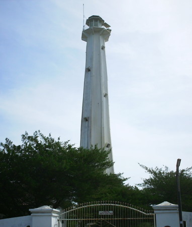
Pandansari Light, Sanden, July 2008
ex-Panoramio photo copyright Satrio Tan; permission requested
Central Java Province South Coast Lighthouses Purworejo Regency Lighthouses
** Ketawang (2?)
Date unknown (before 1998). Active; focal plane 32 m (105 ft); white flash every 4 s (?). Approx. 26 m (85 ft) round white concrete tower with four ribs, lantern and gallery. A photo by Arrina Mayang is at right, a 2013 photo, a closeup photo and another nice photo (2/3 the way down the page) is available, and Google has a satellite view. The tower is very similar to the Pandansari Light. This lighthouse is accessible by road, but it is not well known. Located near the coast about 20 km (13 mi) south of Purworejo. Site open, and Mayang was able to climb the tower. Admiralty Q1276.5; NGA 23822.2.
Kebumen Regency Lighthouses * Klirong (2)
Date unknown. Active; focal plane 42 m (138 ft); white flash every 5 s. Approx. 35 m (115 ft) 4-stage octagonal white concrete tower with lantern and four galleries. A photo is at the top of this page, another photo and a closeup are available, and Google has a street view and a satellite view. The tower is similar to the Bedadung Light shown on the Eastern Java page. The original lighthouse was a square skeletal tower. This lighthouse is in a well-populated area, but it is not on any route likely to be taken by tourists. Located near the coast about 20 km (13 mi) south of Kebumen. Site probably open, tower closed. Admiralty Q1276.2; NGA 23822.4. * Tanjung Karangbata (Karang Batu, Menganti)
Date unknown. Active; focal plane 63 m (207 ft); white flash every 5 s. Approx. 12 m (39 ft) round barbell-shaped fiberglass (?) tower. Entire lighthouse is white. A photo (halfway down the page) is available but Google has a satellite view. Located on heights of a sharp promontory near Ayah, about 30 km (19 mi) west of Kebumen. Site open, tower closed. Admiralty Q1276; NGA 23822.6.
Cilacap Regency Lighthouses Note: Cilicap is the only major commercial port on the south coast of Central Java. The regency has a population of about 1.6 million. * Teluk Penyu
Date unknown. Active; focal plane 17 m (56 ft); white light, 2 s on, 2 s off. 15 m (49 ft) square pyramidal skeletal tower. Google has a street view and Bing has a satellite view. Located on the waterfront of Cilacap's fishing harbor. Site open, tower closed. ARLHS IDO-085; Admiralty Q1267; NGA 23823. 
Ketawang Light, Purworejo, April 2014
photo copyright Arrina Mayang; permission requested
Teluk Penyu Entrance Range Front
Date unknown. Active; focal plane 17 m (56 ft); white light, 2 s on, 2 s off. 17 m (56 ft) square tower, mounted on a square pier supported by piles. Henry Mazuu has a photo, Rian Yulianto has a distant street view from the beach, and Google has a satellite view. Located in the water about 500 m (0.3 mi) east of the rear light. Accessible only by boat. Site open, tower closed. Admiralty Q1270.1; NGA 23828. * Teluk Penyu Entrance Range Rear
2007(?). Active; focal plane 23 m (79 ft); white light, 1 s on, 1 s off. 22 m (72 ft) square skeletal tower, covered with white metal panels. Febri Kustiono has a closeup photo, Rian Yulianto has a distant street view, and Google has a satellite view. In Erwin Hanafi's 2009 photo, the upper panels are missing and the red skeletal structure of the tower is visible. Located on the beach at the Teluk Penyu (Penyu Bay oil terminal near Cilacap. Site apparently open, tower closed. Admiralty Q1270.11; NGA 23832. Teluk Penyu Second Range Front
Date unknown. Active; focal plane 17 m (56 ft); white light, 2 s on, 2 s off. 17 m (56 ft) square tower, mounted on a square pier supported by piles. Soga Soegiarto's photo is at right, Ahmad Fuad Hasan has a view from the beach, and Google has a satellite view. Located in the water about 2 km (1.2 mi) southeast of the Entrance Range Front Light. Accessible only by boat. Site open, tower closed. Admiralty Q1272; NGA 23836. * Teluk Penyu Second Range Rear
2007(?). Active; focal plane 23 m (79 ft); white light, 1 s on, 1 s off. 22 m (72 ft) square skeletal tower, covered with white metal panels. No photo available but Google has a satellite view. Located on the beach at the Teluk Penyu (Penyu Bay) oil terminal near Cilacap. Site apparently open, tower closed. Admiralty Q1272.1; NGA 23840. 
Teluk Penyu Second Range Front Light, Cilacap, August 2010
ex-Panoramio photo copyright Soga Soegiarto; used by permission
Tanjung Karangrempak (Third) Range Front
Date unknown. Active; focal plane 12 m (39 ft); white light, 1 s on, 1 s off. 12 m (39 ft) square tower, mounted on a square pier supported by piles. Yuliyani Kusnanda has a photo of the two range lights and Google has a satellite view. Located in the water about 1 km (1.2 mi) east of the Second Range Lights. Accessible only by boat. Site open, tower closed. Admiralty Q1274; NGA 23844. Tanjung Karangrempak (Third) Range Rear
2007(?). Active; focal plane 17 m (56 ft); white light, 2 s on, 2 s off. 17 m (56 ft) square skeletal tower, covered with white metal panels. Yuliyani Kusnanda has a photo of the two range lights and Google has a satellite view. Located just off the beach about 100 m (330 ft) east southeast of the front light. Site apparently open, tower closed. Admiralty Q1274.1; NGA 23848. Cimiring (Cilacap, Tjilatjap, Noesa Kambangan) (2)
Date unknown (station established 1870). Active; focal plane 178 m (584 ft); white flash every 5.5 s. Listed as a 32 m (105 ft) round stone tower with lantern and gallery, painted white. However, the photo at right, a 2015 photo and another recent photo show a round cylindrical concrete tower with lantern and gallery centered on a round 1-story concrete base; the height appears to be about 12 m (40 ft). This photo is consistent with Google's satellite view of the station. The Tropenmuseum has a historic photo of the original lighthouse, and Huelse has a historic postcard view. Located at the east end of the island of Kambangan, marking the entrance to the port of Cilacap. Accessible by a hiking trail, but local guidance is probably needed. Site open, and visitors are free to climb exterior stairways to the gallery. ARLHS IDO-060; Admiralty Q1268; NGA 23824. 
Cimiring Light, Cilacap, February 2018
ex-Google Plus photo by wahyu budhi s
West Java Province South Coast Lighthouses Pangandaran Regency Lighthouses
* Pangandaran (Teluk Penanjung)
Date unknown. Active; focal plane 12 m (39 ft); white flash every 5 s. 12 m (39 ft) square pyramidal skeletal tower, painted white and mounted on a square platform supported by concrete piles. Teuku Ikram has a street view from a nearby pier and Google has a satellite view. Pangandaran is a beach resort town; it is connected by a narrow isthmus to a nature reserve on the Penanjung Pangandaran (Pangandaran Peninsula). Located just off the beach on the east side of the isthmus in Pangandaran. Site open, tower closed. Admiralty Q1278.2; NGA 23869. * Teluk Parigi
Date unknown. Active; focal plane 12 m (39 ft); white flash every 4 s. Approx. 10 m (33 ft) round barbell-shaped tower. Entire lighthouse is white. Hilman Taofik Hidayah has a 2018 photo and Google has a satellite view. Located just off the beach at Parigi, about 25 km (15 mi) west of Pangandaran. Site open, tower closed. Admiralty Q1278; NGA 23869.5.
Tasikmalaya Regency Lighthouses * Legok (2)
Date unknown. Active; focal plane 42 m (138 ft); white flash every 5 s. Approx. 32 m (105 ft) 4-stage octagonal tower with lantern and gallery, painted white. Ricky Rianto has a 2018 photo (also seen at right), Luthfiyyah Azizah has a 2016 photo, and Google has a street view and a satellite view. The original lighthouse was a skeletal tower. Located near a prominent cape in the Tasikmalaya Regency southwest of Pangandaran. Accessible by road. Site open, tower closed. Admiralty Q1277; NGA 23870. Pulau Manuk (Manuk Island)
Date unknown. Active; focal plane 50 m (164 ft); two white flashes every 10 s. 30 m (98 ft) square skeletal tower with lantern and gallery, painted white. A photo is available and Google has a satellite view. Not to be confused with a much better known Pulau Manuk, a wildlife reserve farther west, near the Sunda Strait. Located on an island just off the coast about 20 km (13 mi) southwest of Cijulang. Accessible only by boat. Site status unknown. Admiralty Q1277.5; NGA 23870.5. 
Legok Light, Tasikmalaya Regency, August 2018
ex-Google Plus photo by Ricky Rianto
Karang Gajah Garut
Date unknown. Active; focal plane 18 m (59 ft); white flash every 4 s. 15 m (49 ft) square skeletal tower with gallery, painted white. No photo available but Google has a satellite view. Located in the surf near a river entrance about 25 km (15 mi) east of Pantai Santolo. Site status unknown. Admiralty Q1278.6.
Garut Regency Lighthouse * Teluk Cilauteureun (Pulau Santolo, Tjilaoeteureum)
Date unknown (station established 1930. Active; focal plane 25 m (82 ft); white flash every 6 s. Approx. 21 m (69 ft) round fiberglass tower with a flared top. Entire lighthouse is white. A photo and a second photo are available, and Bing has a satellite view. Located on Pulau Santolo, an island on the south side of the harbor at Pantai Santolo (Santolo Beach). Site open, tower closed. Admiralty Q1279; NGA 23871.
Cianjur Regency Lighthouses
* Cidaun East
Date unknown. Active; focal plane 17 m (56 ft); white flash every 5 s. 15 m (49 ft) square skeletal tower with gallery, painted white and mounted on a square platform supported by piles. Rendra Dwiariaguna also has a photo, and Google has a satellite view. Located in the surf off a village in the Cidaun area. Site open, tower closed. Admiralty Q1279.3; NGA 23871.2. * Sindangbarang
2017. Active; focal plane 15 m (49 ft); white flash every 5 s. 15 m (49 ft) round barbell-shaped white fiberglass tower mounted on a square platform supported by long piles. Misman Jamaludin has a 2018 photo, Rizkiyana Syabania also has a photo, and Google has a satellite view. Located on the beach at Sindangbarang. Site open, tower closed. Admiralty Q1279.33.
Sukabumi Regency Lighthouses Pulau Ujung Genteng (2)
2007. Active; focal plane 43 m (141 ft); two white flashes every 10 s. 40 m (131 ft) square skeletal tower with lantern and gallery, painted white, mounted on a 2-story coast guard building. A photo is at right, a good closeup and a view from the sea are available, and Bing has a satellite view. Located on an island just off a prominent cape in Sukabumi Regency at the western end of West Java Province. Accessible only by boat. Site status unknown. Admiralty Q1279.5. * Pelabuhan Ratu (Pelabuhanratu) (3?)
Date unknown (station established 1914). Active; focal plane 32 m (105 ft); white flash every 7.5 s. Approx. 22 m (72 ft) square skeletal tower with gallery, painted white. Google has a street view and an indistinct satellite view. Palabuhan Ratu ("Queen's Harbor") is a fishing port and the capital of Sukabumi Regency. Note: NGA lists this light as Q1280, which appears to be a mistake. Located at the end of a gravel bar protecting the harbor. Site open, tower closed. Admiralty Q1279.91; NGA 23871.5. Pelabuhan Ratu Entrance South
Date unknown. Active; focal plane about 16 m (52 ft); green light, characteristic unknown. Approx. 12 m (39 ft) square white skeletal tower. Kang Marno has a photo, and Google has a street view showing both entrance lights, but the tower is hard to distinguish in Google's satellite view. Located on the south side of the narrow entrance to the inner harbor of Pelabuhan Ratu. Site status unknown. Admiralty Q1279.94. 
Pulau Ujung Genteng Light, Ciracap, May 2008
Panoramio photo copyright miurak; permission requested
Pelabuhan Ratu Entrance North
Date unknown. Active; focal plane about 16 m (52 ft); green light, characteristic unknown. Approx. 12 m (39 ft) square white skeletal tower. Najudin Nad has a distant view, and Google has a street view showing both entrance lights, but the tower is hard to distinguish in Google's satellite view. Located on the north side of the narrow entrance to the inner harbor of Pelabuhan Ratu. Site status unknown. Admiralty Q1279.95.
Banten Province Lighthouses Note: Bentan Province was separated from West Java Province in 2000. Most of its lighthouses are on the Sunda Strait, which separates Java from Sumatra is the crucially important gateway to the Java Sea and Jakarta. Pandeglang Regency Lighthouses Pulau Deli
Date unknown. Active; focal plane 45 m (148 ft); two white flashes every 10 s. 40 m (131 ft) square skeletal tower painted white. Several coast guard buildings. No photo available but Google has a satellite view of the station. Located on an island about 50 km (30 mi) southeast of the southern entrance to Sunda Strait. Site status unknown. Admiralty Q1050.4.
Tanjung Layar (Ujung Kulon, First Point) {Eerste Punt, Oedjoeng Koelon} (3)
1906 (station established 1877). Inactive. Approx. 16 m (52 ft) square metal framework tower, painted black (or covered with rust). This lighthouse is at the left in Arief Bidjak's view at right, and Mathieu Haerel has a distant view, but the dark tower does not show up in Google's satellite view. The lighthouse is also seen in a 1926 Tropenmuseum photo and Forand's postcard view. This historic light station is at the extreme southwest tip of Java marking the east side of the entrance to the Sunda Strait from the Indian Ocean. The first lighthouse was a tall cast iron tower. This handsome structure was severely damaged by an earthquake on 1 September 1880, after only three years of service. It was replaced by a brick tower seen in a Tropenmuseum photo. There is a report that foundations of this lighthouse remain. In 1906 the brick lighthouse was damaged by an earthquake and replaced by the skeletal tower. Note: the Indonesian name ujung kulon means "western end." Located at the extreme tip of the point. Accessible only by boat or a long hike. Site open, tower closed. Tanjung Layar (Ujung Kulon, First Point) {Eerste Punt} (5)
Date unknown (station established 1877). Active; focal plane 50 m (164 ft); three white flashes every 15 s. 30 m (98 ft) square tapered metal framework tower, painted white. Several coast guard station buildings. Syolahudin Al Ayubi has a 2016 photo and Google has a satellite view of the station. The present lighthouse is staffed by crews rotating every four months. It replaced a tapered skeletal tower seen in a 2005 closeup and a view from the sea. The area is included in the Ujung Kulon National Park. Located about 300 m (330 yd) northeast of the 1906 lighthouse. Accessible only by boat or a long hike. Site open, tower closed. ARLHS IDO-084; Admiralty Q1050.2; NGA 23332. 
Old (left) and new Tanjung Layar Lights, Ujungjaya, August 2006
Panoramio photo copyright Arief Bidyak; permission requested
Tanjung Waton
Date unknown. Active; focal plane 25 m (82 ft); white flash every 6 s. Approx. 22 m (72 ft) square white skeletal tower. No photo available but Google has a satellite view. Located at the southwestern point of Pulau Panaitan, about 20 km (13 mi) northwest of Tanjung Layar. Accessible only by boat. Site status unknown. Admiralty Q1050.15; NGA 23333.4. Tanjung Parat
Date unknown. Active; focal plane 32 m (105 ft); white flash every 4 s. "White beacon," height unknown, but a tall skeletal tower would be indicated for this location. No photo available but Google has an indistinct satellite view. Located at the northeastern point of Pulau Panaitan, about 30 km (19 mi) north of Tanjung Layar. Accessible only by boat. Site status unknown. Admiralty Q1050.1; NGA 23333. Tanjung Lesung
Date unknown. Active; focal plane 23 m (75 ft); white flash every 4 s. Approx. 21 m (69 ft) square pyramidal skeletal tower with lantern and gallery, painted white. Arris R. Saputra has a photo of the base of the tower, and Google has a satellite view. Located on a prominent cape about 15 km (9 mi) northwest of Panimbang. Accessible only by boat. Site status unknown. Admiralty Q1050.5; NGA 23334.
Serang Regency: Sunda Strait Lighthouses
* Panto Binuangen (Tanjung Pantobinuangen)
Date unknown. Active; focal plane 32 m (105 ft); white flash every 7.5 s. No description given but a tall tower would be required. No photo available. Google has a street view and a second street view of a communications tower that probably carries the light but it has only an indistinct satellite view. Located about 3 km (2 mi) south of the Cikoneng lighthouse (next entry). Site status unknown, but the coastal road passes close to the site. Admiralty Q1050.05; NGA 23335. *** Cikoneng (Tjikoneng, Anyer, Fourth Point) {Vierde Punt} (2)
1885 (station established 1855). Active; focal plane 60 m (197 ft); two white flashes every 20 s. 58 m (190 ft) 12-sided cast iron tower with lantern and gallery. Entire lighthouse painted white. David Howell's photo appears at right, Unian Husien has a 2010 photo, Köhler has a 2011 photo, Gul Chotrani has a closeup, Reez Riezal has another closeup, the Tropenmuseum has three historic photos, and Google has a street view and a satellite view. The lighthouse was prefabricated at The Hague in the Netherlands by Enthoven and Co. It is one the very few Indonesian lighthouses readily accessible to tourists. The original lighthouse was destroyed by tsunami waves triggered by the catastrophic explosion of the Krakatoa volcano on 27 August 1883. These waves were at least 30 m (100 ft) high, obliterating the original light station except for the foundation of the lighthouse. Located on Tanjung Cikoneng near Anyer Kidul on the east shore of Sunda Strait, overlooking the still-active Krakatoa. Accessible by road. Site open, tower open for climbing. ARLHS IDO-081; Admiralty Q1050; NGA 23336. Pulau Ular
Date unknown. Active; focal plane 64 m (210 ft); white flash every 5 s. Approx. 20 m (66 ft) square skeletal tower with gallery, painted white. The lower portion of the tower is seen in Fatoniadi Rachman's view of the island and Bing has a satellite view. Located on a small island about 3 km (2 mi) west of the oil terminal at Kepuh. Accessible only by boat. Site status unknown. Admiralty Q1051; NGA 23340. Pulau Sangiang
Date unknown. Active; focal plane 32 m (105 ft); white flash every 7.5 s. Approx. 15 m (49 ft) square skeletal tower. Lia Pratama has a view from the sea and Google has a satellite view. Pulau Sangiang is a boomerang-shaped island roughly 5 km (3 mi) in diameter in the middle of the narrowest passage of Sunda Strait. Located atop a cliff at the southern tip of the island. Site status unknown. Admiralty Q1051.1; NGA 23342. 
Cikoneng (Anyer) Light, November 2011
Flickr photo copyright David Howell, Peak Design
used by permission
Pulau Tampurung (Toppers Island, Button Island) (2)
Date unknown (station established 1919). Active; focal plane 77 m (253 ft); white flash every 3 s. Approx. 30 m (98 ft) square skeletal tower with lantern and gallery, painted white. Several coast guard buildings. Ayah Maman has a view from the strait and Google has a satellite view. Pulau Tampurung is a small but very high island in the northern entrance to the Sunda Strait, about 10 km (6 mi) northwest of Merak. Located on the highest point of the island. Accessible only by boat. Site status unknown. Admiralty Q1052; NGA 23344.
Serang Regency: North Coast Lighthouses * Karang Antu (Karangantu)
Date unknown. Active; focal plane 13 m (43 ft); white flash every 5 s. 12 m (39 ft) round hourglass-shaped white concrete tower. A photo is available, and Google has a street view and an indistinct satellite view. Located on the west side of the harbor entrance at Kasemen. Site open, tower closed. Admiralty Q1055; NGA 23362. Pulau Tunda (Babi Island) (2)
Date unknown (station established 1890). Active; focal plane 32 m (105 ft); one long white flash every 6 s. 30 m (98 ft) square skeletal tower with lantern and gallery, painted white. Putri Dwi Jayanti has a photo, another photo and a third photo are available, and Bing has a satellite view. This light helps guide vessels between the Sunda Strait and Jakarta. The original lighthouse had a focal plane of 18 m (60 ft). Pulau Tunda is a narrow island about 4.5 km (3 mi) long and about 25 km (15 mi) east of the Sunda Strait entrance. Located on the central south coast of the island. Accessible only by boat. Site status unknown, probably open. ARLHS IDO-256; Admiralty Q1054; NGA 23360.
Information available on lost lighthouses:
Notable faux lighthouses:
Lighthouses of Indonesia: Madura
Indonesia has been independent since 1945, after having been the Dutch East Indies for more than 350 years. It is a huge country, stretching along both sides of the Equator for more than 46 degrees of longitude (roughly 5100 km or 3200 miles). Comprised of some 17,000 islands (more than 6000 inhabited islands), it has hundreds of major aids to navigation. Unfortunately, we have no idea how many of these aids can be considered lighthouses. Information about them is scarce, and photos are even scarcer. Official light lists contain dozens of entries for "framework towers" and "white beacons," providing little guidance for the lighthouse fan.
Madura is a large island off the northeastern coast of Java. The island, roughly 130 km (80 mi) long east to west and up to 35 km (22 mi) wide, is separated from Java by the Madura Strait. At its western end the strait is quite narrow and is crossed by the 5.4 km (3.4 mi) long Suramadu Bridge. On the south side of Madura, however, the strait is a broad sound up to 80 km (50 mi) wide. Madura has a population of roughly 4 million.
Madura is included as part of East Java (Jawa Timur) Province. The island is divided into four regencies. Sumenep Regency, located at the east end of Madura, includes the outlying Masalembu, Sapudi, and Kangean Islands.
The Indonesian word for a lighthouse is mercusuar or (in two words) mercu suar. The phrase menara suar, which includes the Arabic word menara, is sometimes used instead. Tanjung and ujung are words for capes, pulau is an island, selat is a strait, karang is a reef, teluk is a bay or harbor, and pelabuhan is a port. In the Madurese language gili is the word for an island.
The original Dutch names of historic lighthouses, if known, are shown in curly brackets {}.
Aids to navigation in Indonesia are operated and maintained by the Directorate General of Sea Navigation.
ARLHS numbers are from the ARLHS World List of Lights. Admiralty numbers are from volume Q of the Admiralty List of Lights & Fog Signals. U.S. NGA List numbers are from Publication 112. General Sources Leuchttürme in Indonesien
Photos posted by Andreas Köhler. Lighthouses in Indonesia
Wikimedia photos, including a collection of historic photos from the collection of the Tropenmuseum in Amsterdam. World of Lighthouses - Indonesia
Photos by various photographers available from Lightphotos.net. Online List of Lights - Indonesia
Photos by various photographers posted by Alexander Trabas. The Madura photos are by Jim Smith. Indonesian Lighthouses
Historic postcard views from the collection of Michel Forand. Leuchttürme Asiens, Australiens, und Ozeaniens auf historischen Postkarten
Historic postcard views posted by Klaus Huelse. 
Pulau Sapudi Light, Sapudi Islands, April 2011
photo copyright Futuristic Sumenep; permission requested
Bangkalan Regency (Western Madura) Lighthouses Madura Strait Lighthouses Kessek
Date unknown. Active; focal plane 23 m (75 ft); three white flashes every 12 s. 20 m (66 ft) square white skeletal tower. No photo available but Google has a satellite view. Located on a wooded slope on the southwest side of Kessek, the northern terminus of the Suramadu Bridge. Site status unknown. Admiralty Q1170; NGA 23668. Tanjungan
Date unknown. Active; focal plane 13 m (43 ft); yellow flash every 4 s. 13 m (43 ft) round barbell-shaped tower, painted yellow and mounted on a square platform supported by piles. Trabas has Smith's photo and Google has a satellite view. Located about 600 m (3/8 mi) off Tanjungan, at the narrowest passage of the Madura Strait. Accessible only by boat. Site open, tower closed. Admiralty Q1160; NGA 23627.
*** Sembilangan (Ujung Slempit) (Madura Entrance Range Rear) (2)
1882. Active; focal plane 53 m (174 ft: two white flashes every 10 s. 50 m (164 ft) 12(?)-sided cast iron tower with lantern and gallery. Entire lighthouse painted white. Lawrence Eka's photo is at right, Trabas has Smith's photo, Haryono Cokro has a 2008 photo, the Tropenmusuem has a historic photo, and Google has a closeup street view and a good satellite view. There was at least a partial restoration of the lighthouse in 2010. Located on Semibilangan island off the extreme western tip of Madura, this is both a landfall light and the rear light of a range guiding ships into the channel between Madura and Java to approach the port of Surabaya. Accessible by road from Bangkalan, Madura. Site open, tower open although we do not know the schedule. ARLHS IDO-079; Admiralty Q1158.2; NGA 23624. Tanjung Piring (Madura Entrance Range Middle)
Date unknown. Active; focal plane 14 m (46 ft); white flash every 3 s. 14 m (46 ft) square skeletal tower with gallery, painted white. Trabas has Smith's photo and Bing has a satellite view. The listed focal plane seems to be too low. Located on the low cape on the east side of the northern entrance to Madura Strait. Site status unknown. Admiralty Q1158.1; NGA 23620. Madura Entrance Range Front
Date unknown. Active; focal plane 14 m (46 ft); white flash every 3 s. 14 m (46 ft) post mounted on a square concrete platform supported by piles. Lighthouse painted with red and white horizontal bands. The Sembilangan lighthouse is the rear light of this range. Trabas has Smith's photo and Bing has a satellite view. Located 5.1 km (3.2 mi) north northeast of Tanjung Piring. Accessible only by boat. Site open, tower closed. Admiralty Q1158; NGA 23616. Pulau Karang Djamuang (Jamuang) (1)
1971. Inactive since about 2011. Approx. 30 m (98 ft) tapered square skeletal tower painted white. Trabas has Smith's photo, Anoeng Suroboyo's view from the sea shows both lighthouses, Ariedwisoebekto Kariman has a photo in which this older lighthouse can be seen behind the present lighthouse. Located on a small island at the northeastern entrance to the Madura Strait about 13 km (8 mi) north of Bangkalan. Accessible only by boat. Site status unknown. Pulau Karang Djamuang (Jamuang) (2)
2016 (station established 1971). Active; focal plane 41 m (135 ft); white flash every 4 s. 40 m (131 ft) octagonal concrete tower with lantern and double gallery, painted white. Trabas has Smith's photo, Ariedwisoebekto Kariman has a photo, Anoeng Suroboyo's view from the sea shows both lighthouses, and Google has a satellite view. Located on a small island at the northeastern entrance to the Madura Strait about 13 km (8 mi) north of Bangkalan. Accessible only by boat. Site status unknown. ARLHS IDO-065; Admiralty Q1157.5; NGA 23612. 
Sembilangan Light, Pernajuh, June 2011
ex-Panoramio photo by Lawrence Eka; used by permission
North Coast Lighthouse Sapulu
Date unknown. Active; focal plane 10 m (33 ft); yellow flash every 2 s. 10 m (33 ft) round barbell-shaped tower mounted on a platform supported by piles. Google has a satellite view and a distant street view. Located in the entrance to the Bay of Sapulu, a partially-sheltered harbor on the north coast of Madura about 35 km (22 mi) east of the Madura Strait entrance. Accessible only by boat. Site open, tower closed. Admiralty Q1243.5; NGA 23751.
Sumenep Regency Lighthouses Note: The Sumenep Regency includes the eastern end of Madura and a large group of smaller islands lying to the northeast and east.
Northeast Madura Lighthouse Batu Putih (Batuputih)
Date unknown. Active; focal plane 53 m (174 ft); two white flashes every 15 s. Approx. 40 m (131 ft) square skeletal tower with lantern and gallery. Several coast guard station buildings. Lighthouse painted white, lantern red. Google has a street view and a satellite view. This lighthouse is on the northeastern "shoulder" of Madura, helping to guide ships around the east end of the island. Located about 4 km (2.5 mi) east of the village of Batuputih. Site status unknown. ARLHS IDO-092; Admiralty Q1243; NGA 23750.
Masalembu Islands Lighthouses Note: The Masalembu Islands are a small group in the middle of the Java Sea about 160 km (100 mi) northeast of Madura (halfway to Borneo). The islands have a population of about 22,000; boat transportation is available from Sumenep.
* Masalembu (Masalembo) Besar
Date unknown. Active; focal plane 200 m (656 ft); three white flashes every 21.5 s. 40 m (131 ft) skeletal tower with lantern and gallery, painted white; lantern painted red. Heru Purwanto has a 2018 photo, Andreas Pambudi has a closeup, Bung Fadil has a view from the gallery and Google has a satellite view. Located atop the largest and southernmost of the Masalembu Islands. Site open and daredevil visitors can climb the tower. ARLHS IDO-011; Admiralty Q1424; NGA 23592. Masalembu (Masalembo) Besar Southwest
Date unknown. Active; focal plane 14 m (46 ft); red flash every 6 s. 14 m (46 ft) square skeletal tower with gallery, painted red and mounted on a square platform supported by four massive concrete piles. A photo by Said Masalboys is at right, and Google has an indistinct satellite view. Located in an embayment off the harbor of Pulau Masalembu. Accessible only by boat. Site open, tower closed. Admiralty Q1424.5; NGA 23593. * Pelabuhan Masalembu (Masalembo)
Date unknown. Active; focal plane 24 m (79 ft); white flash every 5 s. 20 m (66 ft) square white skeletal tower. Hisam Naim has a photo but the tower is not very conspicuous in Google's satellite view. Located at the ferry terminal on the south side of Pulau Masalembu Besar. Site open, tower closed. Admiralty Q1424.7. Pulau Karamian (Keramian, Karamaian)
Date unknown. Active; focal plane 16 m (52 ft); white flash every 5 s. 15 m (49 ft) square white skeletal tower. This is a staffed coast guard station. No photo available, but Google has an indistinct satellite view of the station. Karamian is a remote island 50 km (30 mi) north of Masalembu Besar and only 100 km (60 mi) south of the coast of Kalimantan (Borneo), but it is inhabited by about 4000 people of Maduran ethnicity. Located at the northern tip of the island. Site status unknown. Admiralty Q1426; NGA 23604. 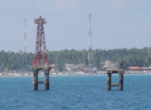
Masalembu Besar Southwest Light, Masalembu Islands, September 2010
Panoramio Creative Commons photo by Said Masalboys
Sapudi Islands Lighthouses Pulau Sapudi (Trebung, Tribung) {Pulau Sapoedi}
1887. Active; focal plane 59 m (194 ft); white flash every 5 s. 58 m (190 ft) octagonal skeletal cast iron tower with lantern, gallery, enclosed watch room, and central cylinder. Entire lighthouse painted white. A photo is at the top of this page, Guntur Sugiatmo has a 2017 photo, the Tropenmuseum has historic photos, and Google has a satellite view of the light station. Located at the west point of Sapudi, an island lying to the east of Madura, marking the passage between the two islands. Site status unknown. ARLHS IDO-091; Admiralty Q1240; NGA 23744. Pulau Kamudi (Kemudi)
Date unknown. Active; focal plane 17 m (56 ft); white flash every 5 s. 17 m (56 ft) white concrete tower with gallery. A small view from the sea is available and Bing has a satellite view of the station. NGA lists the light as "Punta Kamudi." Located on a reef at the extreme eastern end of the Sapudi Islands. Accessible only by boat. Site status unknown. ARLHS IDO-093; Admiralty Q1244; NGA 23752.
Kangean Islands Lighthouses Note: The Kangean Islands are an archipelago northeast of Bali and about 120 km (75 mi) east of Madura. They are well populated with a total of about 125,000 residents.
* Pulau Mamburit
Date unknown. Active; focal plane 45 m (148 ft); white flash every 5 s. Approx. 42 m (138 ft) square skeletal tower with gallery, painted white. Four coast guard station buildings. A photo is at right, the tower is at far right in a distant view by Ainur Rahman, and Google has a satellite view of the station. Located at the north end of a small island off the east end of Pulau Kangean, the largest of the Kangean Islands. Site open, tower closed. Admiralty Q1244.9; NGA 23762. Ketapang Bay
Date unknown. Active; focal plane 16 m (52 ft); white flash every 5 s. 16 m (52 ft) skeletal tower with gallery, painted white and mounted on a square platform supported by piles. No photo available but Google has a satellite view. Located in a bay at the west end of Pulau Kangean, about 2.5 km (1.5 mi) southeast of Pulau Mamburit. Accessible only by boat. Site open, tower closed. Admiralty Q1245; NGA 23756. Pulau Saibus (Saebus)
Date unknown. Active; focal plane 22 m (72 ft; white flash every 6 s. Approx. 19 m (62 ft) square skeletal tower painted white. No photo available but Google has a satellite view. Pulau Saibus is off the southeastern tip of Pulau Paliatq and northwest of Pulau Sepanjang, on the west side of the narrow passage through the Kangean Islands. Located at the base of the pier at the east end of the island. Site status unknown. Admiralty Q1246.3; NGA 23771. Pulau Sesiil (2?)
Date unknown. Active; focal plane 10 m (33 ft) (?); two white flashes every 8 s. Approx. 16 m (52 ft) square pyramidal skeletal tower mounted on a platform supported by piles. No photo available but Bing has a satellite view. The focal plane listed is too low. Located just off a reef at the northeastern tip of Pulau Sepanjang, marking the east side of the narrow passage through the Kangean Islands. Accessible only by boat. Site open, tower closed. Admiralty Q1248.5; NGA 23770. 
Pulau Mamburit Light, Kangean Islands, October 2010
ex-Panoramio photo by onatali; permission requested
Pulau Sepanjang
Date unknown. Active; focal plane 44 m (144 ft); white flash every 4 s. Approx. 40 m (131 ft) square tapered skeletal tower with lantern and gallery, painted white. Several coast guard station buildings. No photo available but Google has a satellite view of the station. Located at the southeastern tip of Pulau Sepanjang, the second largest of the Kangean Islands. Site status unknown. ARLHS IDO-095; Admiralty Q1246.5; NGA 23768. Pulau Sakala
Date unknown. Active; focal plane 46 m (151 ft); three white flashes every 20 s. 40 m (131 ft) tapered square skeletal tower, painted white. No photo available but Google has an indistinct satellite view. Pulau Sakala is the easternmost of the Kangean Islands and the easternmost territory of East Java Province. The island has a population of about 2500. Located at the eastern tip of the island. Accessible only by boat. Site status unknown. ARLHS IDO-094; Admiralty Q1247; NGA 23764.
Southeast Madura Lighthouses * [Kaliangat Range Front]
Date unknown. Active; focal plane 10 m (33 ft); continuous green light. 8 m (26 ft) square pyramidal white skeletal tower. Google has a street view and Bing has an indistinct satellite view. Kaliangat is the port associated with Sumenep, the regency capital. Located on the waterfront at Kaliangat. Site open, tower closed. Admiralty Q1236; NGA 23728. * Kaliangat Range Rear
Date unknown. Active; focal plane 18 m (59 ft); continuous red light. 13 m (43 ft) square pyramidal white skeletal tower. Google has a closeup street view but the tower is hard to see in Bing's satellite view. Kaliangat is the port associated with Sumenep, the regency capital. Located 146 m (160 yd) northeast of the front light, near a mosque. Site open, tower closed. Admiralty Q1236.1; NGA 23732.
* Tanjung Madura (Tanjung Saronggi) (2?)
Date unknown. Active; focal plane 18 m (59 ft); white flash every 3 s. 13 m (43 ft) white concrete tower. A portion of Aulia Hanif's photo is at right, Ody Anjar has a closeup photo, another photo (second photo on the page) is available, and Google has a satellite view. NGA lists a skeletal tower at this location. More information is needed about this station; according to research by Michel Forand the station was established by 1917 but the light has always been described as a skeletal tower. The location is known locally simply as Tanjung and the Admiralty lists the light oddly as Tanjung Tanjung ("Cape Cape"). Located at the southeastern tip of Madura. Accessible by road. Site open, tower closed. ARLHS IDO-162; Admiralty Q1232; NGA 23724. Gili Genteng (Pulau Giligenteng) (1 and 2)
Date unknown. Active; focal plane 15 m (49 ft); three white flashes every 15 s. 11 m (36 ft) white tower on a platform supported by piles. No photo available. Google's satellite view shows that this lighthouse has been replaced by a post on a new platform about 30 m (100 ft) west of the former platform; Bing's satellite view shows both platforms. Gili Genteng is an inhabited island in the Madura Strait off the southeastern coast of Madura. Note: gili is the Madurese word for "island," so "Pulau Giligenteng" is redundant. Located about 300 m (0.2 mi) off the western tip of Gili Genteng. Accessible only by boat. Site open, tower closed. Admiralty Q1230; NGA 23720. Gili Raja (Pulau Giliraja)
Date unknown. Active; focal plane 42 m (138 ft); white flash every 6 s. Approx. 35 m (115 ft) square tower, painted white. No photo available but Google has a satellite view. Gili Raja is an inhabited island in the Madura Strait off the southeastern coast of Madura a few miles west of Gili Genteng. Located at the east end of the island. Site status unknown. ARLHS IDO-090; Admiralty Q1228; NGA 23718. 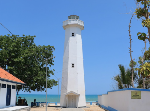
Tanjung Madura Light, Sumenep, October 2018
ex-Google Plus photo by Aulia Hanif
Pamekasan Regency South Coast Lighthouses Madura Strait Lighthouses
Gili Dua (Pulau Gilidua)
Date unknown. Active; focal plane 20 m (66 ft); white flash every 3 s. 20 m (66 ft) "white beacon" mounted on a platform supported by piles. No photo available but Bing has an indistinct satellite view. Located on a reef about 15 km (9 mi) west of Gili Raja and the same distance off the south coast of Madura. Accessible only by boat. Site open, tower closed. Admiralty Q1226; NGA 23716. Camplong East
Date unknown. Active; focal plane 24 m (79 ft); white flash every 5 s. 21 m (69 ft) square skeletal tower. Google has a street view and a satellite view. Located on the quay of the Pt. Garam Terminal on the east side of Camplong. Site status unknown. Admiralty Q1225.5; NGA 23715. * Camplong
Date unknown. Active; focal plane 21 m (69 ft); four white flashes every 20 s. 19 m (62 ft) square skeletal tower with gallery, covered by white metal panels. Detta Priyandikawardhana's photo is at right and Google has a satellite view. Located near an oil terminal at Camplong on the central south coast of Madura. Site open, tower closed. ARLHS IDO-089; Admiralty Q1225; NGA 23714. Karang Koko (Madura Strait, Zwaantjes Reef) {Zwaantjes Droogte} (2)
Date unknown (station established 1871). Active; focal plane 18 m (59 ft); three white flashes every 13 s. 16 m (52 ft) tower mounted on a round pier. Lighthouse painted black with one red horizontal band. No photo available but Bing has a satellite view. Forand has a historic photo of the original Dutch lighthouse; a Java Post article from April 2012 has additional photos and information about the lighthouses of this unusual class. Located on a dangerous reef in the Madura Strait about 25 km (15 mi) northeast of Pasuruan. Accessible only by boat. Site open, tower closed. ARLHS IDO-145; Admiralty Q1200; NGA 23676. 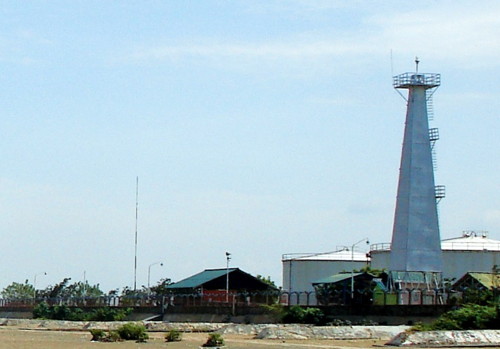
Camplong Light, July 2010
Panoramio photo copyright Detta Priyandikawardhana; permission requested
Information available on lost lighthouses:
Notable faux lighthouses:
Tuesday, January 28, 2020
LightHouse Java and surroundings
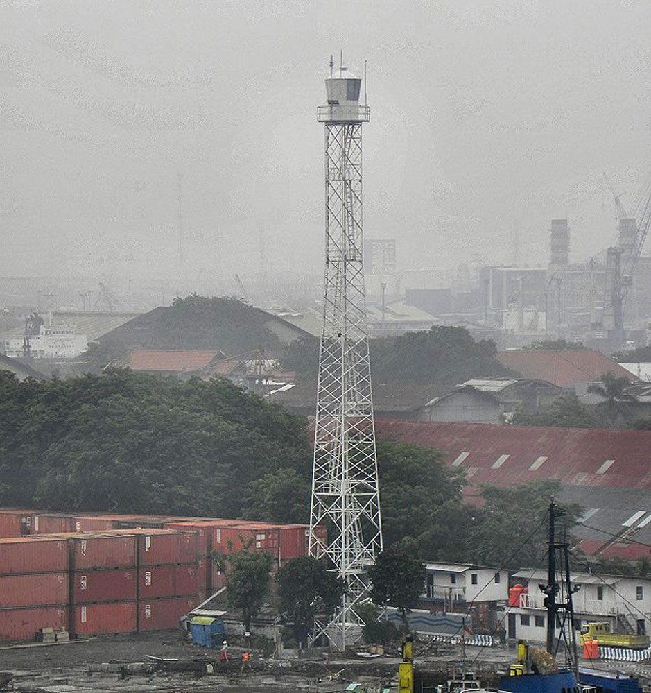
1.jpg)
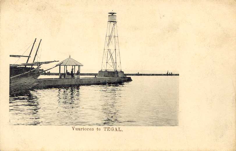
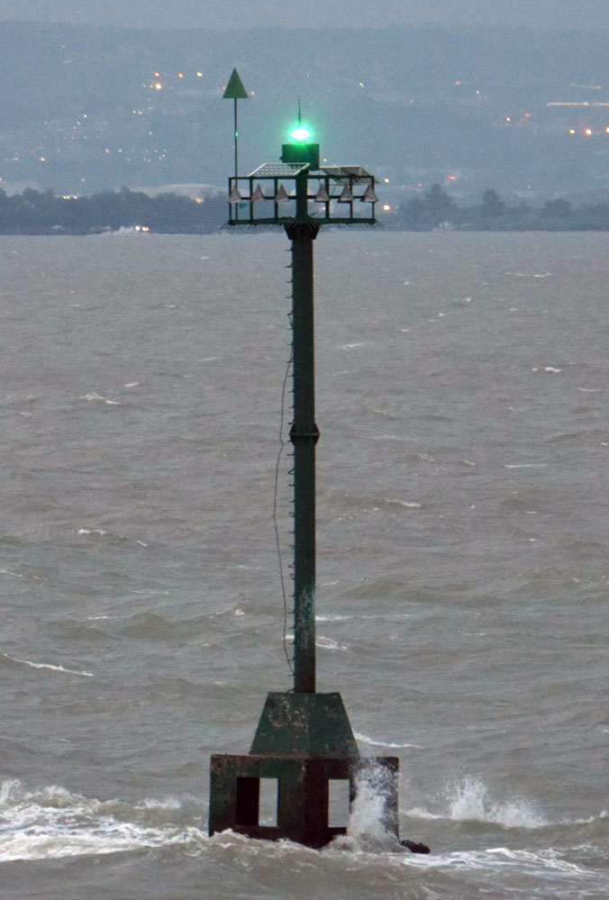
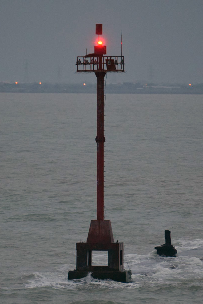
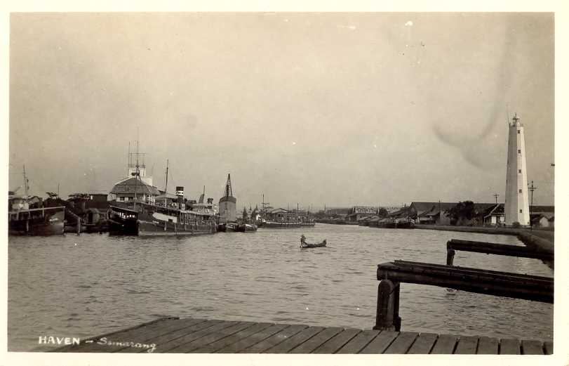
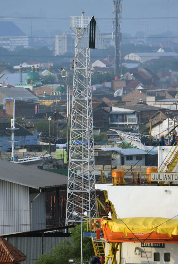
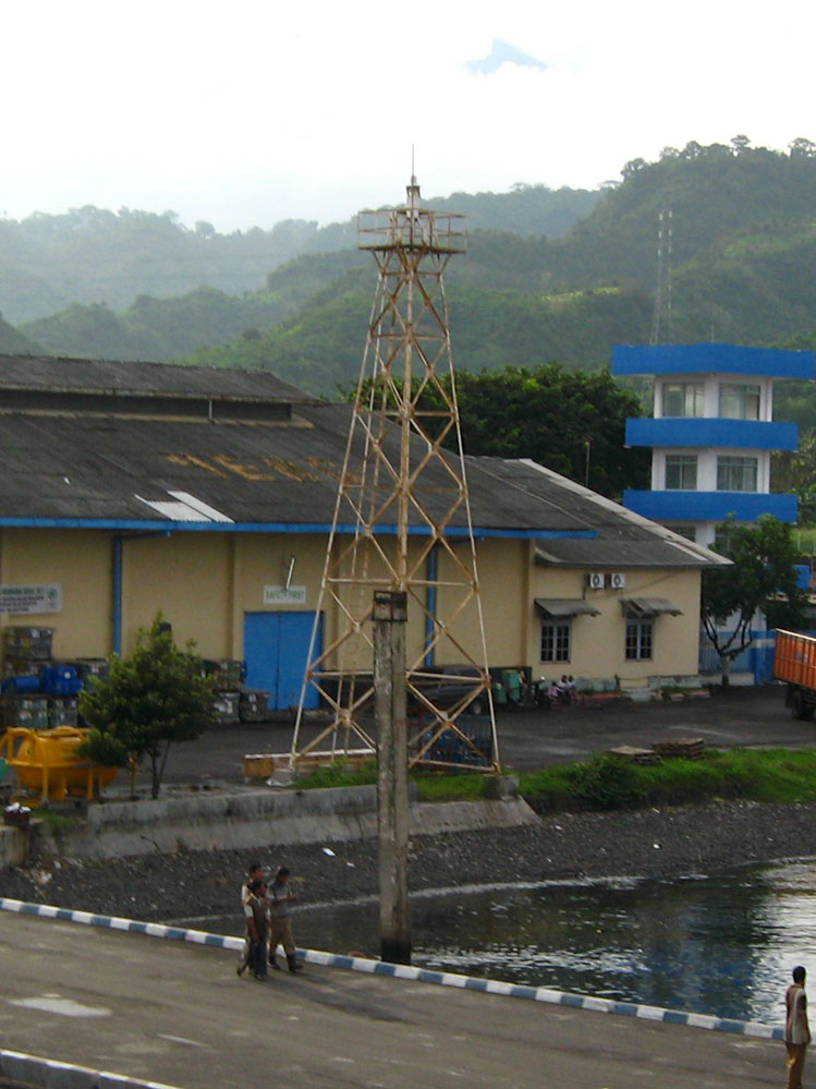
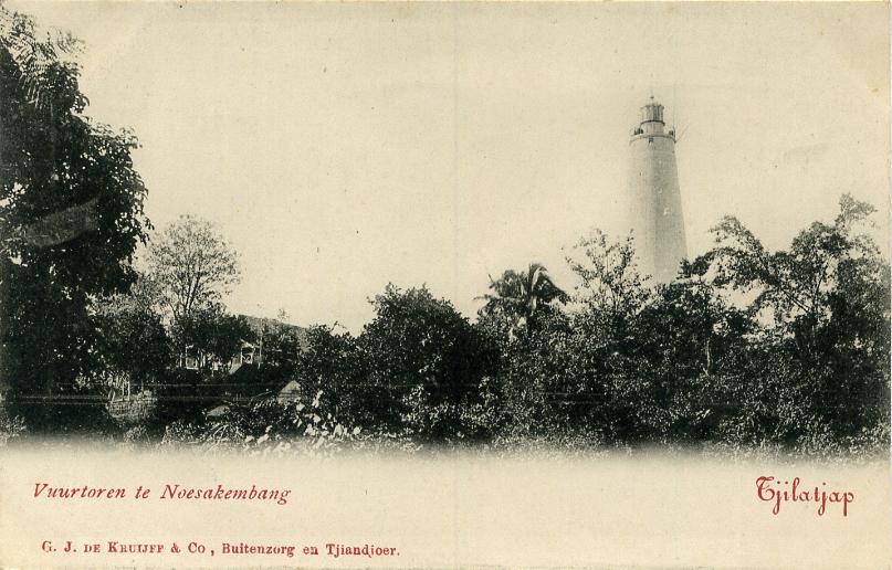
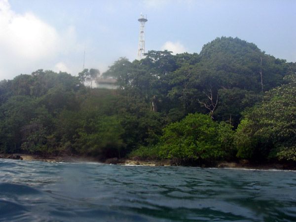
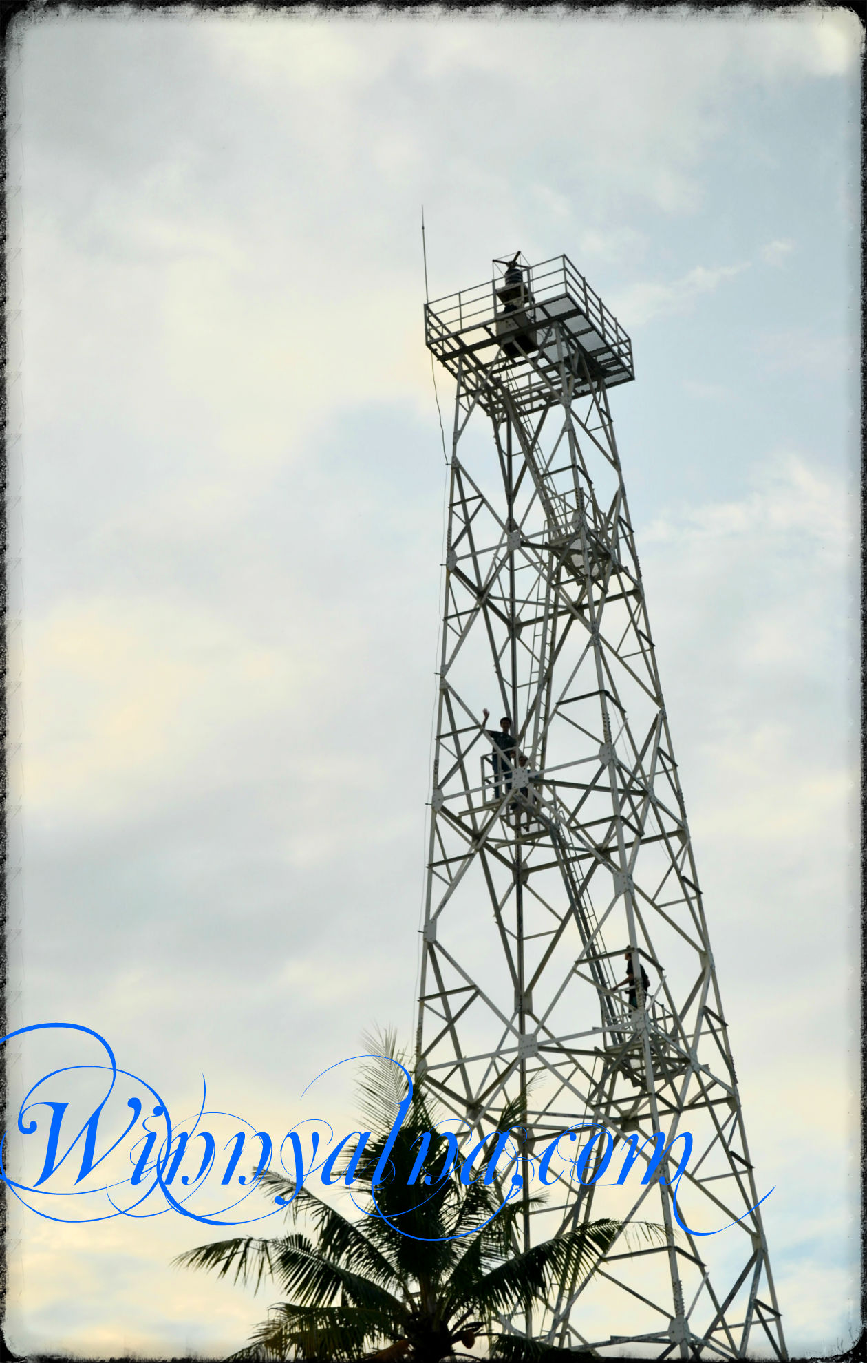
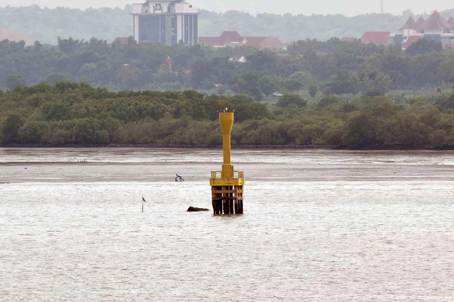
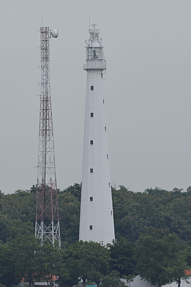
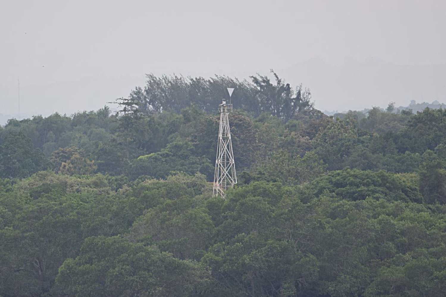
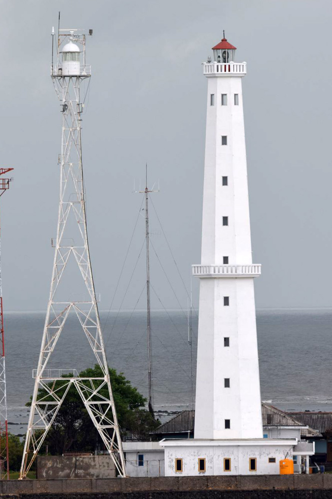
Subscribe to:
Post Comments (Atom)
No comments:
Post a Comment