
http://www.unc.edu/~rowlett/lighthouse/idri.htm
Lighthouses of Indonesia: Northern Sumatra
| Indonesia has been independent since 1945, after having been the Dutch East Indies for more than 350 years. It is a huge country, stretching along both sides of the Equator for more than 46 degrees of longitude (roughly 5100 km or 3200 miles). Comprised of some 17,000 islands (more than 6000 inhabited islands), it has hundreds of major aids to navigation. Unfortunately, it's difficult to know how many of these aids can be considered lighthouses. Information about them is scarce, and photos are even scarcer. Official light lists contain dozens of entries for "framework towers" and "white beacons," providing little guidance for the lighthouse fan. Sumatra (or, as Indonesians prefer, Sumatera) is the world's sixth largest island and the westernmost of the major islands of Indonesia. It is separated from Malaysia to the north by the Malacca Strait, from Borneo to the northeast by the broad Karimata Strait, and from Java to the southeast by the Sunda Strait. Its south coast faces the open Indian Ocean. This page includes lighthouses of North Sumatra province and Aceh territory, located at the northwestern end of the island. This page is probably not complete. Listed here are towers at locations known to be historic Dutch light stations, plus some additional sites at which there is some evidence for a lighthouse. Added to this is an appeal for more information and photos; if you know about lighthouses in Indonesia, please share that knowledge. Note: Lighthouses of Bangka and Belitung, formerly listed under Sumatra, now have a separate page. The Indonesian word for a lighthouse is mercusuar. The phrase menara suar, which includes the Arabic word menara, is sometimes used instead. Tanjungand ujung are words for capes, pulau is an island, selat is a strait, and teluk is a harbor. Aids to navigation in Indonesia are operated and maintained by the Indonesian Directorate of Marine Navigation (Indomarinav). ARLHS numbers are from the ARLHS World List of Lights. Admiralty numbers are from volumes F and K of the Admiralty List of Lights & Fog Signals. U.S. NGA List numbers are from Publication 112.
|  Breueh Light, Aceh, May 2010 photo copyright Douglas Cameron; used by permission |
Lighthouses of North Sumatra Province's West Coast
- Batu Islands Area Lighthouses
- Note: The Batu (Stone) Islands are located in the Indian Ocean 50-200 km (30-125 mi) southwest of the North Sumatran coast. There are three prinicpal islands: Tanahbala and Tanahmasa in the south, separated by a narrow channel, and Pini in the north. The Equator passes just to the south of Pini.
- Pulau Bojo (Bodjo)
- 1883. Active; focal plane 119 m (390 ft); white flash every 4 s. 60 m (197 ft) round cast iron tower with lantern and gallery, painted white. Adjoining keeper's houses are occupied by resident keepers. One of Dietrich Lange's photos is at the top of this page, KITLV has a 1914 photo, and Google has a good satellite view. The purpose of this landfall light is to mark the passage between the Batu Islands and the island of Siberut, leading to the port of Padang. Located on an island just off the south tip of Pulau Tanahbala, the southernmost of the major Batu Islands, about 200 km (125 mi) west northwest of Padang. Accessible only by boat. Site open, tower open by arrangement with the keepers. ARLHS IDO-070; Admiralty K0842; NGA 23192.
- Pulau Sigata
- Date unknown (station established 1913). Active; focal plane 116 m (381 ft); four very quick white flashes every 3 s. 35 m (115 ft) cast iron skeletal tower, painted white. No current photo available, but KITLV has a 1914 photo. We do not know if the historic lighthouse survives. Google's distant satellite viewhas no detail in the area. Located on a small island of the Batu group, northwest of Tanahmasa. Accessible only by boat. Site status unknown. ARLHS IDO-076; Admiralty K0838; NGA 23204.
- Pulau Pini
- Date unknown. Active; focal plane 42 m (138 ft); white flash every 8 s. 30 m (98 ft) skeletal tower, painted white. No photo available, and Google's distantsatellite view does not show the station. Pulau Pini is a substantial island, about 40 km (25 mi) long, at the northeast corner of the Batu group. Located at the western tip of the island. Site status unknown. ARLHS IDO-241; Admiralty F1235; NGA 23209.
- Pulau Temang
- Date unknown (station established 1913). Active; focal plane 65 m (213 ft); white light, 3 s on, 6 s off. 22 m (72 ft) skeletal tower, painted white. No photo available, and Google's distant satellite view does not show the station. KITLV has a historic photo of the original lighthouse, but we do not know if it survives. Located at the west end of an island just off the mainland coast near Batahan. Accessible only by boat. Site status unknown. ARLHS IDO-252; Admiralty F1238; NGA 23220.
Pulau Nias Area Lighthouses- Note: Nias is a large island (more than 5000 km2) about 140 km (88 mi) off the Sumatran coast and 80 km (50 mi) northwest of the Batu group. It has a substantial population, more than 750,000, although it does not attract many Western tourists. The island is accessible by air and by ferries from Sibolga on the mainland of North Sumatra.
- Pulau Hinaka (Hinako)
- 1912. Active; focal plane 54 m (177 ft); white flash every 5 s. 32 m (105 ft) cast iron skeletal tower, painted white. No photo available. KITLV has a historic photo of the original lighthouse, and Google's satellite view indicates that this historic tower survives. This lighthouse guides vessels passing Nias to the west. Located on a small island in the Indian Ocean about 10 km (6 mi) off the west coast of Nias. Accessible only by boat. Site status unknown. ARLHS IDO-198; Admiralty F1254; NGA 23240.
- Pulau Sumabawa
- Date unknown. Active; focal plane 33 m (108 ft); white flash every 4 s. 30 m (98 ft) skeletal tower, painted white. No photo available, and the island is only a blur in Google's satellite view. Located on an island about 12 km (7.5 mi) off the east coast of Nias. Accessible only by boat. Site status unknown. ARLHS IDO-260; Admiralty F1257; NGA 23246.
- Tanjung Mbaa
- Date unknown. Active; focal plane 75 m (246 ft); white flash every 5 s. 21 m (69 ft) cast iron skeletal tower, painted white. No photo available, and the tower has not been located in Google's satellite view of the cape. The light guides vessels approaching Gunungsitoli, the administrative center of the island, on the northeast coast. Located on a promontory about 3 km (2 mi) north of Gunungsitoli. Site status unknown. ARLHS IDO-286; Admiralty F1248; NGA 23248.
- Gosong Baohi
- Date unknown. Active; focal plane 28 m (92 ft); white flash every 5 s. 25 m (82 ft) cast iron skeletal tower, painted white. No photo available; Google has a satellite view that may show the light. This lighthouse guides vessels to the port of Lahewa. Located on an island off the northwestern coast of Nias. Accessible only by boat. Site status unknown. ARLHS IDO-129; Admiralty F1250; NGA 23260.
- Bintanah
- Date unknown. Active; focal plane 33 m (108 ft); white flash every 5 s. 30 m (98 ft) cast iron skeletal tower, painted white. No photo available, and Google's satellite view shows only a blur. Located on an island in the center of the Mentawai Strait, midway between Nias and the Sumatra mainland. Accessible only by boat. Site status unknown. ARLHS IDO-112; Admiralty F1262.3; NGA 23267.
Sibolga Area Lighthouses
Labu Labu Kecil- Date unknown. Active; focal plane 57 m (187 ft); two white flashes every 7 s. 40 m (131 ft) skeletal tower, painted white. No photo available; Google has a distant satellite view of the island. Located on a small island on the west side of the southern entrance to the bay of Sibolga. Accessible only by boat. Site status unknown. ARLHS IDO-152; Admiralty F1262.5; NGA 23269.
- Ujung Karang
- Date unknown. Active; focal plane 41 m (134 ft); three white flashes every 17 s. 40 m (131 ft) skeletal tower, painted white. No photo available. Located on a peninsula sheltering the west side of the bay of Sibolga. Site status unknown. ARLHS IDO-349; Admiralty F1263; NGA 23284.
 Pulau Bojo Light, October 2008 photo copyright Dietrich Lange; used by permission |
Lighthouses of Aceh
- Note: Located at the northwestern end of Sumatra, Aceh was the scene of a lengthy and sometimes violent separatist movement, first against Dutch control and then against Indonesian administration. Following the disastrous tsunami of 26 December 2004, a peace agreement negotiated with the help of Finnish diplomats was signed in August 2005. Aceh is governed not as a province of Indonesia but as a "special territory" enjoying a considerable degree of autonomy. The capital is Banda Aceh, and the territory has a population of roughly four million.
West Coast (Indian Ocean) Lighthouses - Singkil (Singkel) (2)
- Date unknown (station established 1912). Active; focal plane 33 m (108 ft); white flash every 6 s. 30 m (98 ft) skeletal tower, painted white. No photo available, and Google's satellite view has no detail in this area. A 1917 coast pilot lists the original light with a focal plane of 21 m (69 ft). Located at the entrance to the port of Pasar Singkel in the extreme southern end of Aceh. Site status unknown. ARLHS IDO-279; Admiralty F1267; NGA 23292.
- Tinggi
- Date unknown. Active; focal plane 40 m (131 ft); white flash every 3 s. 30 m (98 ft) skeletal tower, painted white. No photo available, and Google has only a fuzzy satellite view of the area. The lighthouse guides vessels approaching Simeulue Barat, a port on the northeast coast of Simeulue, a large island off the west coast of Aceh. Located on a small island about 4 km (2.5 mi) off the coast of Simeulue. Accessible only by boat. Site status unknown. ARLHS IDO-341; Admiralty F1278; NGA 23310.
- Ujung Kareueng (Teluk Muelaboh) (2?)
- Date unknown. Active; focal plane 27 m (89 ft); white light, 2 s on, 6 s off. 25 m (82 ft) square cylindrical skeletal tower, painted white. In an aerial photo of the promontory, the tower is barely visible at the extreme tip of the point (use maximum magnification). This area was swept clean by the 2004 tsunami, so the presnt lighthouse may be new. Located on a promontory at Muelaboh. Site status unknown. ARLHS IDO-350; Admiralty F1292; NGA 23328.
- Krueng Teunom
- Date unknown. Active; focal plane 34 m (111 ft); red flash every 7.5 s. 30 m (98 ft) skeletal tower, painted white. No photo available, and the tower has not been located in Google's satellite view. Located at the Teunom River entrance northwest of Suak Uleue. (The river entrance is blocked by a bar, so this must be a coastal light rather than a harbor light.) Site status unknown. ARLHS IDO-149; Admiralty F1292.2; NGA 23328.5.
- Ujung Baro
- Date unknown. Active; focal plane 60 m (197 ft); two white flashes every 10 s. 30 m (98 ft) skeletal tower, painted white. No photo available, but Google has a satellite view. Located on a promontory near Alue Titi. Site status unknown. ARLHS IDO-347; Admiralty F1292.35; NGA 23329.5.
- Rangas (Pulau Rangas)
- Date unknown. Active; focal plane 50 m (164 ft); white flash every 5 s. NGA provides no description of this light; Google's satellite view reveals what is probably a white skeletal tower at least 20 m (66 ft) tall. No photo available. Located on a small island about 3 km (1.75 mi) southwest of Ujung Baro. Accessible only by boat. Site status unknown. ARLHS IDO-261; Admiralty F1292.3; NGA 23329.
Pulau Rondo and Pulau Weh Lighthouses- Pulau Rondo
- Date unknown. Active; focal plane 193 m (633 ft); three white flashes every 20 s. 40 m (131 ft) skeletal tower with lantern and gallery, painted white. A photo is at right, but Google's satellite view has only a blur for the island. Pulau Rondo is the northwesternmost island of Indonesia, about 25 km (15 mi) northwest of Brueh. The island is inhabited and is sometimes visited by scuba divers. There is also a small Indonesian military outpost on the island. Accessible only boat. Site status unknown. ARLHS IDO-369; Admiralty F1300; NGA 22232.
- * Breueh (Pulau Brueh, Pulau Bras, Willemstoren)
- 1875. Active; focal plane 160 m (525 ft); two white flashes every 10 s. 44 m (144 ft) round stone tower with lantern and gallery, painted red with one very broad white horizontal band. Douglas Cameron's photo is at the top of this page, a recent photo is available, KITLV has a historic photo, Wikimedia has three historic photos from the collection of the Amsterdam Tropenmuseum, and Google has a satellite view. This light marks the extreme northwestern corner of Indonesia, the island of Breueh off the northwestern end of Sumatra. Breueh was devastated by the tsunami of 26 December 2004, but this lighthouse was far above the waves. Some of its support buildings were destroyed, however. Located at the northwestern tip of Weh, about 40 km (25 mi) northwest of Banda Aceh. There are ecotours to the island, and the light station is accessible by road. Site open, tower status unknown. ARLHS IDO-051; Admiralty F1302; NGA 22236.
- Pulau Klah (Pulau Weh) (2)
- Date unknown (station established 1905). Active; focal plane 31 m (102 ft); white light, 7 s on, 23 s off. 10 m (33 ft) skeletal tower with lantern and gallery, painted white. Hantu Laut has a photo, and Google has a satellite view. KITLV has a double-exposed 1914 photo of the original lighthouse (on the right in the photo). The lighthouse is high enough to have escaped damage from the tsunami of 26 December 2004, but might have been damaged by the earthquake. Located on a small island in the entrance to the harbor of Sabang, about 40 km (25 mi) north of Banda Aceh. Accessible only by boat. Site status unknown. ARLHS IDO-208; Admiralty F1310; NGA 22244.
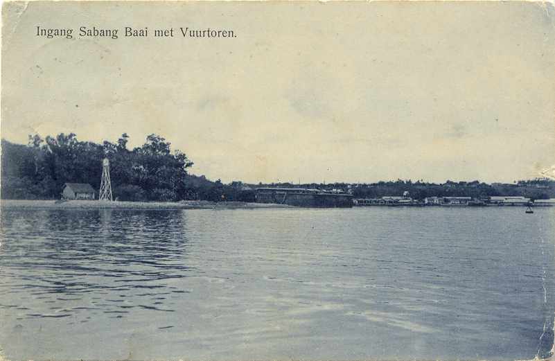
- Ujung Lhome (Teluk Sabang, Sabang Harbor, Ujung Lho Me, Massam Point) (2)
- 2005(?) (station established 1905). Active; focal plane 16 m (52 ft); three white flashes every 15 s. 15 m (49 ft) round concrete tower, painted white. No photo available, but Google has a satellite view. Klaus Huelse has a historic postcard view of the original lighthouse. If this tower was still standing in December 2004, it would almost certainly have been destroyed by the tsunami. Located on the north side of the entrance to Sabang harbor. Site status unknown, possibly open; tower closed. ARLHS IDO-208; Admiralty F1312; NGA 22240.
- Le Meule (Ujung Tapagaya, Ujung Baratlaut) (2)
- Date unknown (station established 1905). Active; focal plane 29 m (95 ft); white flash every 5 s. 25 m (82 ft) square skeletal tower with gallery, painted white. No photo available, but Google has a satellite view. KITLV has an odd double-exposed 1914 photo in which the lower portion of the Meule tower is seen at the left, against the vegetation. Located at the northern point of Pulau Weh. Site probably open, tower closed. ARLHS IDO-340; Admiralty F1308; NGA 22260.
- Ujung Seuke
- Date unknown (1980s?). Active; focal plane 85 m (279 ft); white flash every 2.5 s. Tall square skeletal tower with gallery (and lantern?), painted white. No photo available, but Google has a satellite view. Located on the southeastern tip of Pulau Weh about 10 km (6 mi) southeast of Sabang. Site status unknown. Admiralty F1314; NGA 22258.
Banda Aceh Area Lighthouses- Pulau Bunta
- Date unknown. Active; focal plane 90 m (295 ft); four white flashes every 20 s. Approx. 40 m (131 ft) square skeletal tower with lantern and gallery, painted white. Jürgen Klinksiek's 1998 photo is at right, but the shadow of the tower is hard to discern in Google's satellite view of the light station. This light marks the beginning of the approach to Banda Aceh from the Indian Ocean. Pulau Bunta is an island off the extreme northwestern tip of Sumatra. Located at the western tip of the island, about 18 km (11 mi) west of Banda Aceh. Accessible only by boat. Site status unknown. Admiralty F1295; NGA 22238.
- #Ulee Lheue (Banda Aceh)
- Date unknown. Status unknown. Approx.18 m (59 ft) square concrete pylon, unpainted. The beacon originally had a lantern, but no pre-tsunami photos have been found. The tsunami swept entirely over the tower, ripping off the lantern and creating a lasting symbol of its fury. A closeup photo of the result is available. The tower has disappeared from Google's satellite view. Located on a low island sheltering Ulee Lheue, the harbor district of Banda Aceh. Accessible only by boat. Site open, tower closed.
- * Sungai Aceh (Atjeh River) (2)
- 2005? Active; focal plane about 15 m (49 ft); white flash every 5 s. Approx. 15 m (49 ft) square skeletal tower with gallery, standing on a concrete platform supported by four piles. Entire lighthouse is white. A good photo is available. This lighthouse replaced a somewhat smaller light destroyed by the tsunami. Located just offshore at the entrance to the Aceh River in Banda Aceh. Site open, tower closed. Admiralty F1314.5; NGA 22280.
- Pulau Buru (2)
- Date unknown (station established 1889). Active; focal plane 14 m (46 ft); white flash every 3 s. 15 m (49 ft) cylindrical tower with gallery, centered on a square base. Lighthouse painted white. Michael Thirnbeck has an aerial photo, and Google has a satellite view. This lighthouse may have escaped serious damage by the 2004 tsunami, because it is built on an isolated island too small (only 50 m (160 ft) in diameter) to trigger the great waves to rise up to destructive size. KITLV has a historic photo of the original lighthouse, a hexagonal skeletal tower with lantern. Located about 15 km (9 mi) north of Banda Aceh and a similar distance south of Pulau Weh. Accessible only by boat. Site status unknown. Admiralty F1315; NGA 22268.
East Coast (Andaman Sea and Strait of Malacca) Lighthouses- Ujung Pidie
- Date unknown. Active; focal plane 60 m (197 ft); three white flashes every 20 s. 40 m (131 ft) skeletal tower, painted white. No photo available, and Google's satellite view has no detail at this cape. This lighthouse marks a prominent cape about 80 km (50 mi) east of Banda Aceh and 16 km (10 mi) northwest of Sigli. Site status unknown. ARLHS IDO-344; Admiralty F1319; NGA 22286.
- Lhokseumawe (2)
- Date unknown (station established 1904). Active; focal plane 22 m (72 ft); white flash every 3 s. 13 m (43 ft) iron framework tower, painted white. No photo available. KITLV has a historic photo of the original lighthouse; it was of similar size but the focal plane was only 15 m (49 ft). Located in Lhokseumawe, a city about 160 km (100 mi) east of Banda Aceh. Site status unknown. ARLHS IDO-157; Admiralty F1324; NGA 22356.
- Tanjung Jambuair (Tanjung Jamboaye, Diamantpunt) (2)
- Date unknown (station established 1905). Active; focal plane 44 m (144 ft); one long (1.5 s) white flash every 5 s. 40 m (131 ft) skeletal tower on an octagonal base. Lighthouse painted white. No photo available, and Google has only a distant satellite view of the cape. KITLV has a photo of a scale model of the original lighthouse, a 26 m (85 ft) screwpile tower. This lighthouse is on Sumatra's northern "shoulder," marking the south side of the entrance to the Strait of Malacca. Located on Tanjung (cape) Jambuair, about 40 km (25 mi) east of Lhokseurnawe. Site status unknown. ARLHS IDO-083; Admiralty F1327; NGA 22364.
- * Idi
- Date unknown (station established 1905). Active; focal plane 20 m (66 ft); white flash every 3 s. 20 m (66 ft) iron skeletal tower, painted white. No current photo available. KITLV has a historic photo of the original tower, a 20 m (66 ft) hexagonal skeletal tower. Perhaps this lighthouse survives, but we have no evidence of it. Located at Idi, a town about 50 km (30 mi) southeast of Tanjung Jambuair. Site status unknown. ARLHS IDO-083; Admiralty F1327.5; NGA 22368.
- Ujung Tamiang
- Date unknown. Active; focal plane 44 m (144 ft); three white flashes every 20 s. 40 m (131 ft) skeletal tower, painted white. No photo available, but Google has a very fuzzy satellite view. Located just off a swampy cape about 35 km (22 mi) east of Langsa. Site status unknown. ARLHS IDO-345; Admiralty F1334; NGA 22394.

 Pulau Bunta Light, 1998 photo copyright Jürgen Klinksiek used by permission |
Lighthouses of North Sumatra Province's East Coast
- Malacca Strait Lighthouses
- Nipahlarangang
- Date unknown. Active; focal plane 44 m (144 ft); three white flashes every 20 s. 40 m (131 ft) skeletal tower, painted white. No photo available. A Google satellite view shows a station of some kind, but the tower is not discernible. Located on a low cape about 16 km (10 mi) north of Belawan. Site status unknown. ARLHS IDO-172; Admiralty F1352; NGA 22400.
- Pankalan Dodek (2)
- Date unknown (station established 1906). Active; focal plane 18 m (59 ft); white flash every 5 s. 15 m (49 ft) "white beacon," according to NGA. No photo available, and Google has only a very distant satellite view of the area. KITLV has a distant view of the original lighthouse, which had a focal plane height of 15 m (49 ft). Located on the south side of the entrance to the Pangkalan River about 20 km (13 mi) northwest of Tanjungbalai. Site status unknown. Admiralty F1376.5; NGA 22458.
- Pulau Salahnama (South Brother Island)
- Date unknown. Active; focal plane 121 m (397 ft); white flash every 6 s. 30 m (98 ft) "white beacon," according to NGA. No photo available, and Google has only a very blurry satellite view. This island and its shorter neighbor Pulau Pandang (North Brother) are well-known hazards to navigation along the Sumatran coast. Located on an island in the Strait of Malacca about 20 km (13 mi) off the coast north of Tanjung Balai. Accessible only by boat. Site status unknown. Admiralty F1378.5; NGA 22462.
Information available on lost lighthouses:
- Bandar Kalifah (1905-?), Strait of Malacca
- Pangkalanbrandan (1919-?), Strait of Malacca
- Sinabang (1912-?), western Aceh
Notable faux lighthouses:
No comments:
Post a Comment